
Rally on the Rift
GREAT RIFT COMMUNITY ADVENTURE RIDE & CHALLENGE
JUNE 4th – 9th 2024
SIGN UP HERE
A remote, Idaho bikepacking journey through the Craters of the Moon National Monument & Preserve
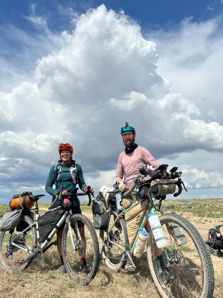
Combine the solitude of bikepacking the Great Rift Dirt Tour with the camaraderie of an incredible bikepacking community!
These are the traditional and ancestral lands home to the Northern Shoshone, Western Shoshone, Bannock, Northern Paiute, Cayuse, Umatilla, Walla Walla, and many other indigenous peoples.
ABOUT THE RIDE & CHALLENGE
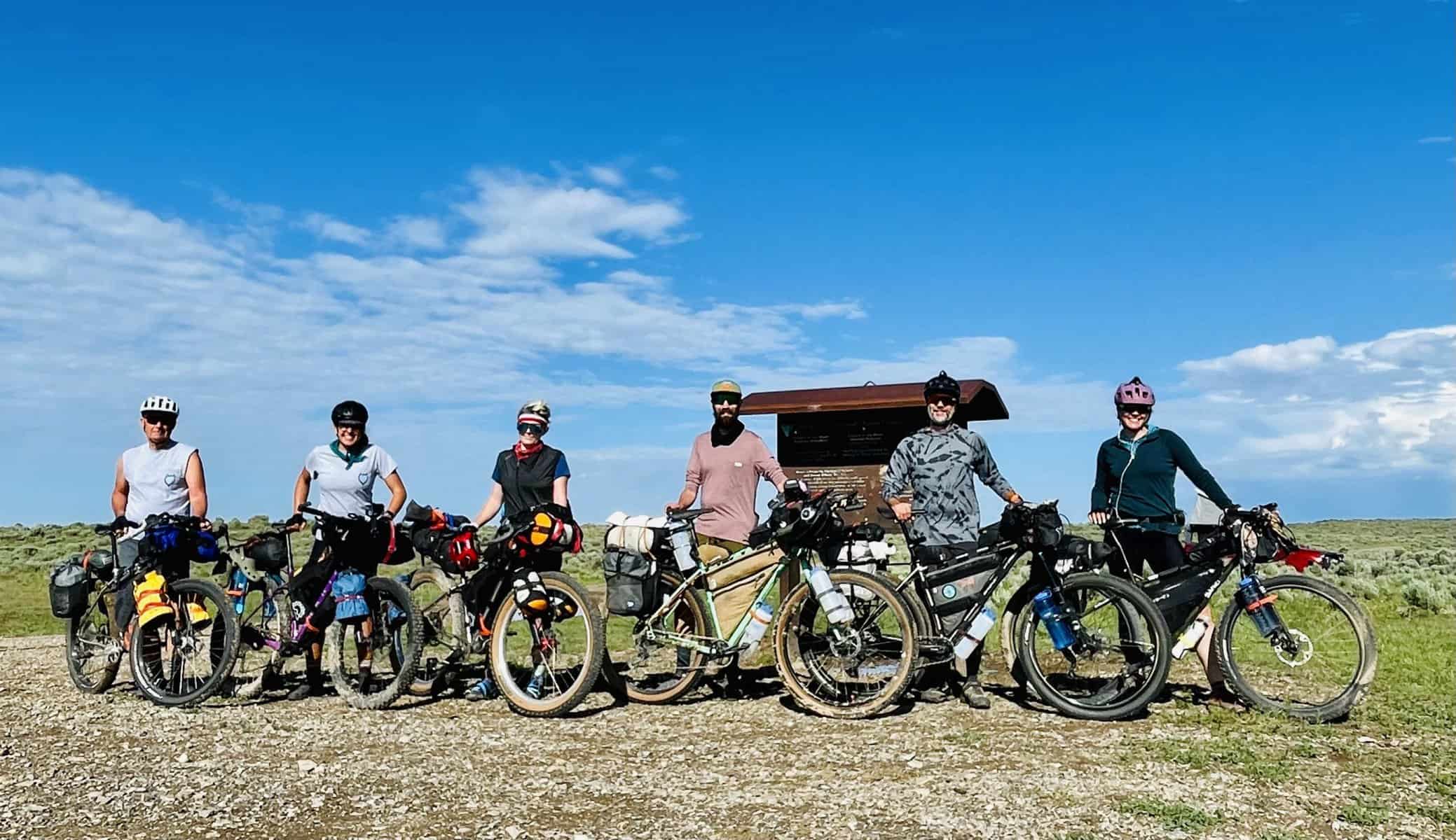
You’re invited on this Idaho bikepacking adventure ride through Craters of the Moon National Monument and Preserve to celebrate the Great Rift Dirt Tour becoming a Bikepacking Roots Community Route!
Everyone is welcome! However, the remoteness of the region and long stretches without water, make this an advanced route.
Self-supported riding and navigation skills are necessary to complete the full loop.
This ride is intended to introduce folks like yourself to a region that hasn’t seen many bikepackers. While the route is challenging, bringing folks together can make it more fun and enjoyable, knowing others are out there overcoming the same things you are!
Many rides and events often end with a lackluster finish – with no one to congratulate, greet, welcome, and high-five you at the end. Out in the Great Rift Backcountry, you’re likely to spend a lot of time in solitude. How great would it be to enjoy the company of others and share in the stories of the past 5 days at the finish? This is the goal!
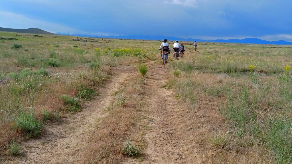
Solitude is expected in this wild place. At times we’ll spread a part and other times some may randomly link up riding the same pace. If you find yourself in the company of others, enjoy it.
~
Enjoy the company, embrace the solitude
~
SCHEDULE
TUES, JUNE 4, 6 pm
CAMP
Roll in when you can. No hard time. Dial in your bike. Set up camp. Make dinner. Visit.
WED, JUNE 5,
7:30 am
PRE-RIDE CHAT & PHOTOS
We’ll have a brief pre-ride chat. I’ll go over some reminders and information on the route, and answer any last minute questions
8:00 am
ROLL OUT!
We’ll head down the slow & bumpy doubletrack.
JUNE 5 – 9
RIDE!
Ride at your own speed. This is not a group ride or a race, but you might find yourself riding at the same pace as others.
SUN, JUNE 9
FINISH & CAMP
Maybe I’ll be there, maybe you’ll beat me. We’ll hang out at the finish as folks roll in, high-five, & crack some cold beverages. Those who can are encouraged to camp one final night.
*Dates and times are subject to weather conditions and may change at any time leading up to the scheduled ride date.
We will plan to follow the official Great Rift Dirt Tour route, however, you may ride any sections in any direction that you would like.
WHAT IS THE GREAT RIFT DIRT TOUR?
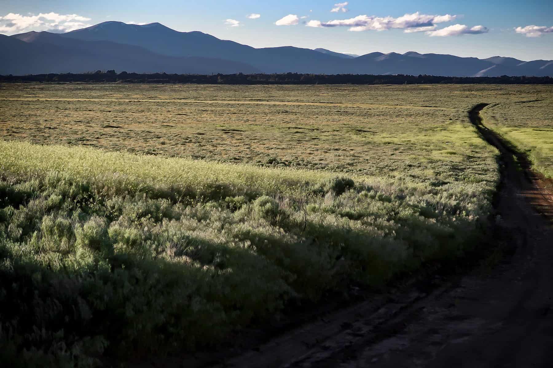
Connecting rugged doubletrack and 4×4 roads, the Great Rift Dirt Tour is a backcountry ride through Craters of the Moon Monument and Preserve, likely some of the last remote and least developed country still accessible by bicycle.
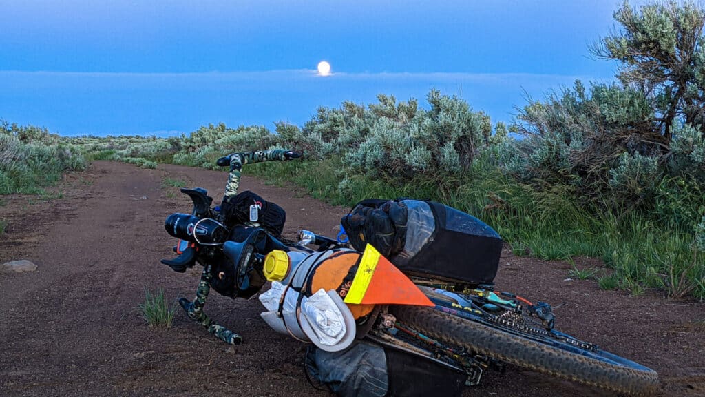
Camp inside an expired volcano, ride along old wagon ruts from the Oregon Trail, take in the night sky under a bright full moon or dark starry night, enjoy the vibrant colors of blooming sagebrush, wildflowers and lush wild grasses, and watch a migrating herd of pronghorn in the distance while meandering the narrow doubletrack in wide-open space!
SELF EXPLORATION & CAMARADERIE
Combine the solitude of human-powered and self-supported exploration through Craters of the Moon National Monument and Preserve in Idaho with the camaraderie of an incredible bikepacking community!
Discover and expand your awareness of the ecological and biological magic of the Idaho Sagebrush Steppe across the Snake River Plain and Columbia Plateau!
Enjoy the ride, soak in your surroundings (and maybe even a warm spring!), sleep under the stars, leave no trace, and finish in 5 days.
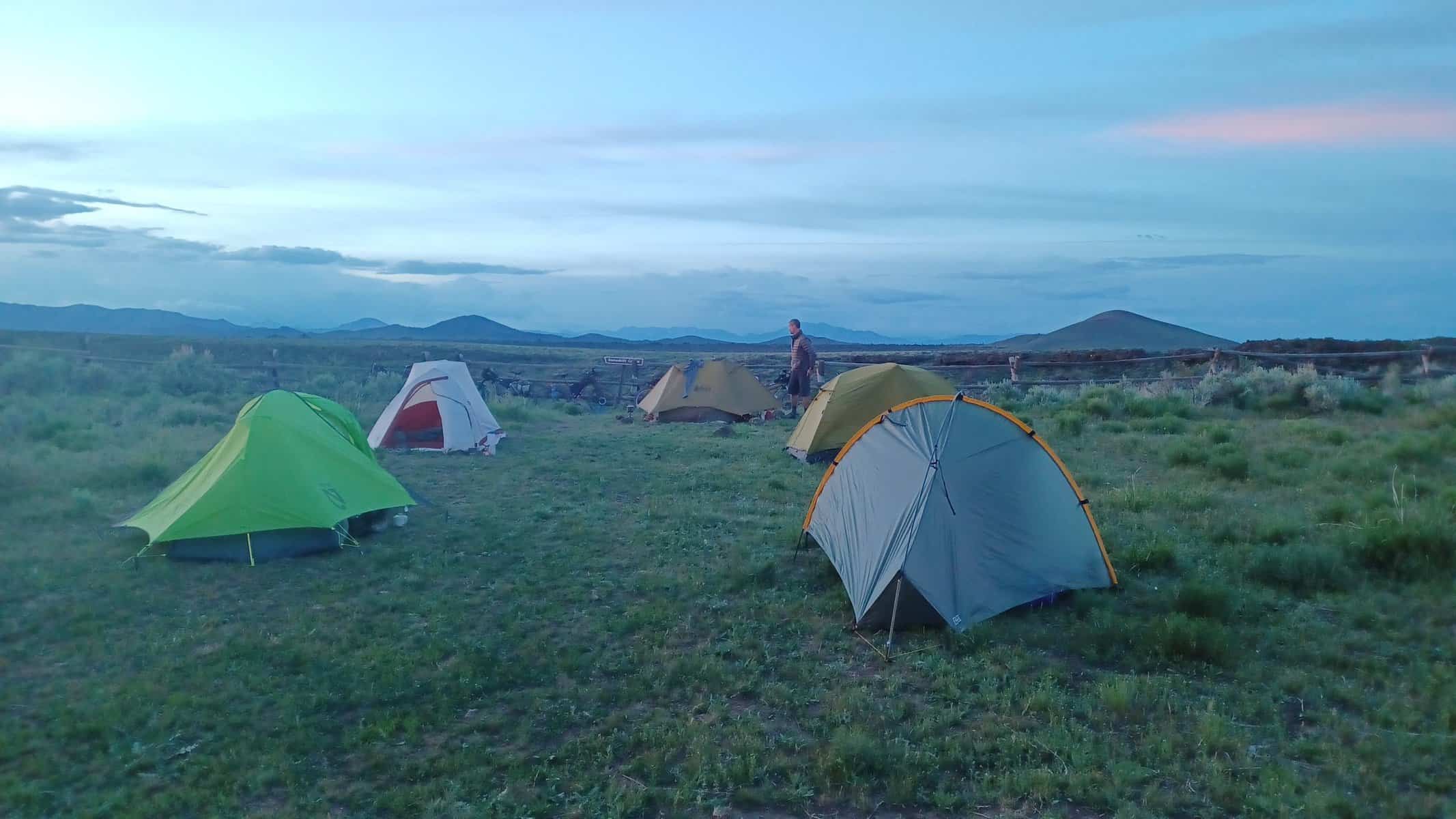
CAMPING
Most of the Craters of the Moon Preserve is open to dispersed camping, although not everywhere is suitable. There are a few good options for camping listed below, and are also mentioned in more detail on the route.
Always camp responsibly and practice Leave No Trace land ethics.
Refer to the FAQ section on camping in a group for more info.
PRE & POST-RIDE CAMP
Car camping before the ride will be at the start/end of the Great Rift Dirt Tour route. There is a large open space accessible to large vehicles and trailers, and is accessible by 2WD vehicles. Tent camping, campers, vans, etc. are all suitable here.
NIGHT ONE
-
Sand Butte (~56 miles in)
-
Confluence of Silver Creek & Little Wood River (~69-70 miles in)
-
Silver Creek Developed Campground (~74 miles in)
NIGHT TWO
-
Snowdrift Crater (~118 miles or 141 miles in depending on chosen direction of Interior Loop)
NIGHT THREE
-
Camp along the last “Side Quest” (~mile 178.5)
-
Lava Campground in Craters of the Moon Monument (~mile 184.5)
-
Hike into CRMO Wilderness (~mile 189 + 2-4 miles of hiking)
-
Honeys Park in Arco (slightly off route between miles 217 & 218)
NIGHT FOUR
-
Honeys Park in Arco (slightly off route between miles 217 & 218)
-
Dispersed Camping on BLM land halfway between Arco & finish
WANT TO RIDE FASTER OR SLOWER?
That’s fine! No one is expected to ride at a specific pace or stay with a group. You’re encouraged to ride the pace that is comfortable to you. Finishing in 5 days is a challenge, but it’s very doable.
To take more time than 5 days (such as spending a zero day at the CRMO Monument), plan to start sooner on June 4th so that we see you out there and you finish on the same day!
If your plan is to ride faster, it’s recommended to start a day or two later (June 5th or 6th) with the plan to finish on June 9th. At the finish, stick around, camp the final night, and welcome other riders as they roll into the finish at Kings Bowl.
NOTE: riding this whole route in less than 4 days is very challenging.
“The weirdly wonderful landscape of the lava flows are rock solid now, but at one time molten magma raged and exploded here. The pattern of the flow is now frozen for us to see. A reminder of the power and balance of nature and our temporary place in it.
If you go, be prepared physically, cognitively and emotionally for this expansive adventure.”
~Rebecca Rusch | Finding Balance In Nature
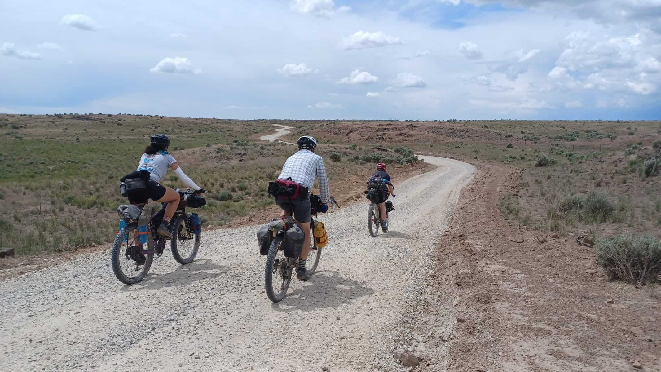
ROUTE
Riders can prepare to be immersed in the expansive, Idaho High Desert of the Snake River Plain as they skirt expansive lava flows, meander along the foothills of the Pioneer Mountains, and travel through the vast Sagebrush Steppe on the Columbia Plateau.
SURFACE DETAILS
86% UNPAVED | 14% PAVED
-
BLUE = DOUBLETRACK/4×4
46% | 131 miles
(Rocky, Rutted, Eroded, Sometimes Faint) -
RED = ROUGH DIRT/GRAVEL
27% | 75.5 miles
(4WD, Rugged, Loose, Less Maintained) -
PURPLE = IMPROVED GRAVEL
13% | 38 miles
(2WD, Smoother, Graded) -
GREEN = BIKE PATH
0.5% | 1 mile
(Non-motorized, Paved) -
BLACK = VEHICLE PAVEMENT
13.5% | 39 miles
(Smooth, Maintained, Highways)
QUESTIONS & RESOURCES
The Great Rift Dirt Tour Route Guide on Bikepacking Roots is an in-depth and detail source containing all the information you’ll need for a successful trip, including a detailed overview, route statistics and surface details, and planning logistics with sections focusing on Weather, Water, Food and Resupply, Desert Safety, Highway Riding Tips, Gear Recommendations, Wildlife Safety and Food Storage, and Camping.
The Frequently Asked Questions section below covers several other pointed topics that folks have wondered about the route and this specific event. Lastly, the new Great Rift Dirt Tour Community & Discussion group is a great resource to assist you as you plan for this adventure.
After Signing up, you will receive a Welcome Document chock-full of resources, need-to-know information, recommended gear list, and other helpful tips for a successful ride!
REGISTRATION & SIGN-UP
PLEASE SIGN UP HERE
After registering, you will receive an email regarding the schedule, where to meet, resources, and updates. After submitting the form, you will receive a Welcome Doc via email with all the information you need to have an enjoyable and safe adventure.
This is a free event. Route development and event planning is a labor of love. To help continue these projects and make bikepacking more accessible, you can make donations to the following:
Bikepacking Roots
(tax deductible)
NEED MORE BIKEPACKING INSPIRATION?
Check out the complete Great Rift Dirt Tour photo gallery or join the Great Rift Dirt Tour Community & Discussion Group!
FREQUENTLY ASKED QUESTIONS
Is this a race or may I race this route?
This event is not a race, although you may ride the route as fast as you would like. I personally found the terrain and weather in the Great Rift Backcountry easy to underestimate. Be careful going into this route with the goal of riding fast and light. Much of the route lies within areas where help is a long way away if something goes wrong. Secondly, some of the rugged double-track roads and high winds can make a handful of miles take much longer than you anticipate.
How much does this event cost?
This event is free! The event and route are a labor of love to the Bikepacking Community and can’t exist without your help. To show your thanks and to help continue future route improvements and developments, donations can be made to Destination Reroute through PayPal. THANK YOU!
Tax-deductible donations may be made through Bikepacking Roots. Please mention that it’s for the Great Rift Dirt Tour.
Do I need to pay to enter Craters of the Moon National Monument?
Short answer: yes. Cost is around $10 per person.
The route enters the Craters of the Moon National Monument fee area near mile 185. The entrance gate lies just down the road from the Visitor Center near the Campground Entrance. To proceed along the road, all riders must pay the fee or have one of the accepted Interagency Passes.
I’d like to ride this faster, is that alright?
Absolutely.
However, bikepacking Craters of the Moon and the Idaho High Desert is best enjoyed at a less grueling pace. There’s a lot to be enamored by as you’re immersed in this terrain. This route was developed with this in mind.
Should you choose to ride faster you’re highly encouraged to try to start later and plan to end on the 9th. The goal here is to welcome fellow riders as they trickle into Kings Bowl after 5 days of wild exploration! I feel like this is where some of these events fall short and I’m aiming to change that.
Is this a group ride?
Not technically, no. A group ride typically indicates that people will start, ride and finish together. This would be very difficult to accomplish over the course of 5 days and 283 miles.
While the plan for this ride is for us to start together and welcome each other in at the finish, people are not expected to stick together or ride at a certain pace. If you would like to ride with someone, it’s best to plan that in advance. That said, if enough people show up oftentimes we find ourselves riding at the pace of others or leapfrogging each other. This is all a part of the experience and the “randomness” that rally-style bikepacking rides like this can offer. I encourage you to ride with folks if you want, while also embracing the solitude when it presents itself… because it will present itself.
What about camping in a group?
Please do!
Much of the Craters of the Moon Preserve is open to dispersed camping, although not all places are suitable for such.
There’s no pressure to make it a certain distance to camp with others. While some may make it 80+ miles on day one, others may only make it 50. That’s ok. Please camp where you deem fit, safe, and responsible. We may end up camping with each other at times, and that’s ok too!
Please see the Camping section for more info on recommended spots.
Are support vehicles and water caches allowed?
On the topic of “support vehicles”, it’d be good to approach it like a “trail angel” – someone who is out there to aid not just you, but your fellow riders as well.
Support vehicles are allowed, however, I ask that you consider the following if taking this approach:
If everyone had a support vehicle, the Great Rift Backcountry and CRMO Preserve would certainly not feel as remote or wild. One of the beauties out here is seeing no one! Several vehicles could potentially irresponsibly impact the region as well. If you would like to have a support vehicle, please contact Aaron.
Are there any aid stations?
There are no aid stations. If you or someone you know would like to offer some aid to all participants, please contact Aaron to discuss further.
I’d like to start [here] instead, may I? And what do you think about that?
Sure! Start wherever you’d like, as long as there’s a good spot to leave your vehicle overnight for several days.
The starting point for the Great Rift Dirt Tour route is strategic, though can be difficult to get to. Starting at Kings Bowl breaks up a 138-mile section of some very remote and rugged terrain, with unreliable water sources. Keep this in mind when planning. Lastly, finishing in the same spot reduces our impact in many areas and encourages the building of community.
May I ride the route in a different direction?
Absolutely. The route flows well both ways. Starting clockwise gets the most difficult and remote riding out of the way sooner. It also positions Arco later in the route with more food options, services, etc. instead of closer to the beginning.
The Interior Loop may be ridden in either direction. Riding counterclockwise can be a strategic decision, allowing to cover more miles (40 instead of 20), but camping at the same location marked on the map (Snowdrift Crater).
Why is the group number limited to 74 people?
It’s not random. Most public land areas require a special use permit for a gathering of 75 people or more at a single time. Also, 74 people all on bikes out here would be nuts! Simply in the fashion of limiting our impact, this is a good number to remain at. If there is a demand for more participants in the future, we can revisit this.
June? In the Idaho Desert? Isn’t it going to be hot?
The timing of riding this route is pertinent to the weather and the access to water. Spring season in this region ranges from April to early June.
Timing matters in regards to water as well. We want wells full, water spigots running and the Robert Limbert Visitor Center open longer hours and more frequently.
June is a wonderful month to ride this route with the blooming wildflowers, lush grasses, and increased water availability. For best results, plan the trip around the forecast and be prepared for changes in the weather.
Always be prepared for all types of weather and temperatures.
Recommendations for managing heat and sun exposure: sun hoody, handkerchief or neck gaiter, sunscreen, and staying up on electrolytes, water, and food.
Can I bikepack on my gravel bike?
As per my other statements, I’m not going to tell anyone what they can or can’t ride. I personally believe there‘s little difference in efficiency between a 40mm tire and a 2.2” tire on this route. There are many great bike options out there, but a dropbar mountain bike, such as a Salsa Fargo, is an excellent choice for this route.
That said, rung what ya brung! Just know what you’re in for!
I’m struggling with [something]. Any tips?
There are some intimidating and difficult logistics to factor for on this route. I get it! If you have specific questions regarding preparations that I haven’t covered, feel free to contact Aaron.
- Please avoid driving on doubletrack sections where it would require riders to dismount or the vehicle to drive off the road onto the vegetation.
- Please consider offering support (if needed), such as water or a kind wave, and a brief chat to anyone else riding the route at this time too.
- Caching water is great – make sure to mark it with a date, name & phone number so others know (consider having enough to share with others)
- YOU ARE RESPONSIBLE FOR PACKING OUT ALL WATER CONTAINERS
If everyone had a support vehicle, the Great Rift Backcountry and CRMO Preserve would certainly not feel as remote or wild. One of the beauties out here is seeing no one! Several vehicles could potentially irresponsibly impact the region as well. If you would like to have a support vehicle, please contact Aaron.
Are there any aid stations?
There are no aid stations. If you or someone you know would like to offer some aid to all participants, please contact Aaron to discuss further.
I’d like to start [here] instead, may I? And what do you think about that?
Sure! Start wherever you’d like, as long as there’s a good spot to leave your vehicle overnight for several days.
The starting point for the Great Rift Dirt Tour route is strategic, though can be difficult to get to. Starting at Kings Bowl breaks up a 138-mile section of some very remote and rugged terrain, with unreliable water sources. Keep this in mind when planning. Lastly, finishing in the same spot reduces our impact in many areas and encourages the building of community.
May I ride the route in a different direction?
Absolutely. The route flows well both ways. Starting clockwise gets the most difficult and remote riding out of the way sooner. It also positions Arco later in the route with more food options, services, etc. instead of closer to the beginning.
The Interior Loop may be ridden in either direction. Riding counterclockwise can be a strategic decision, allowing to cover more miles (40 instead of 20), but camping at the same location marked on the map (Snowdrift Crater).
Why is the group number limited to 74 people?
It’s not random. Most public land areas require a special use permit for a gathering of 75 people or more at a single time. Also, 74 people all on bikes out here would be nuts! Simply in the fashion of limiting our impact, this is a good number to remain at. If there is a demand for more participants in the future, we can revisit this.
June? In the Idaho Desert? Isn’t it going to be hot?
The timing of riding this route is pertinent to the weather and the access to water. Spring season in this region ranges from April to early June.
Timing matters in regards to water as well. We want wells full, water spigots running and the Robert Limbert Visitor Center open longer hours and more frequently.
June is a wonderful month to ride this route with the blooming wildflowers, lush grasses, and increased water availability. For best results, plan the trip around the forecast and be prepared for changes in the weather.
Always be prepared for all types of weather and temperatures.
Recommendations for managing heat and sun exposure: sun hoody, handkerchief or neck gaiter, sunscreen, and staying up on electrolytes, water, and food.
Can I bikepack on my gravel bike?
As per my other statements, I’m not going to tell anyone what they can or can’t ride. I personally believe there‘s little difference in efficiency between a 40mm tire and a 2.2” tire on this route. There are many great bike options out there, but a dropbar mountain bike, such as a Salsa Fargo, is an excellent choice for this route.
That said, rung what ya brung! Just know what you’re in for!
I’m struggling with [something]. Any tips?
There are some intimidating and difficult logistics to factor for on this route. I get it! If you have specific questions regarding preparations that I haven’t covered, feel free to contact Aaron.


