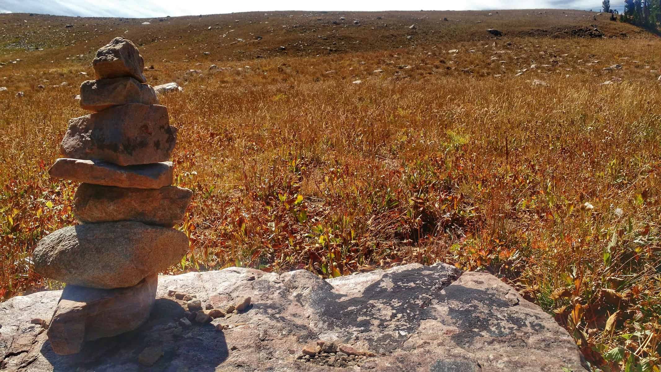
What does one call a trek across the Tetons? Paul Petzoldt referred to it as the High Adventure Trail. “High” is certainly apt, as is “adventure”. That’s for certain. This, however, is more of a route than a trail. It runs across the entire Teton Range, north to south, down and up canyons, over mountain passes, above glaciers, along lakes in subalpine basins, across high desert granite “flats” and meadows, and that’s if you’re lucky enough to have a trail at all. The route involved a scramble through iced-over rock slides and boulder-littered scree fields, a steep ascents straight up mountainsides and across vole-infested ground (think: summer version of postholing). These were times where it was a constant effort looking for any indication of a trail, which mostly consisted of the rare cairn or a cut log.
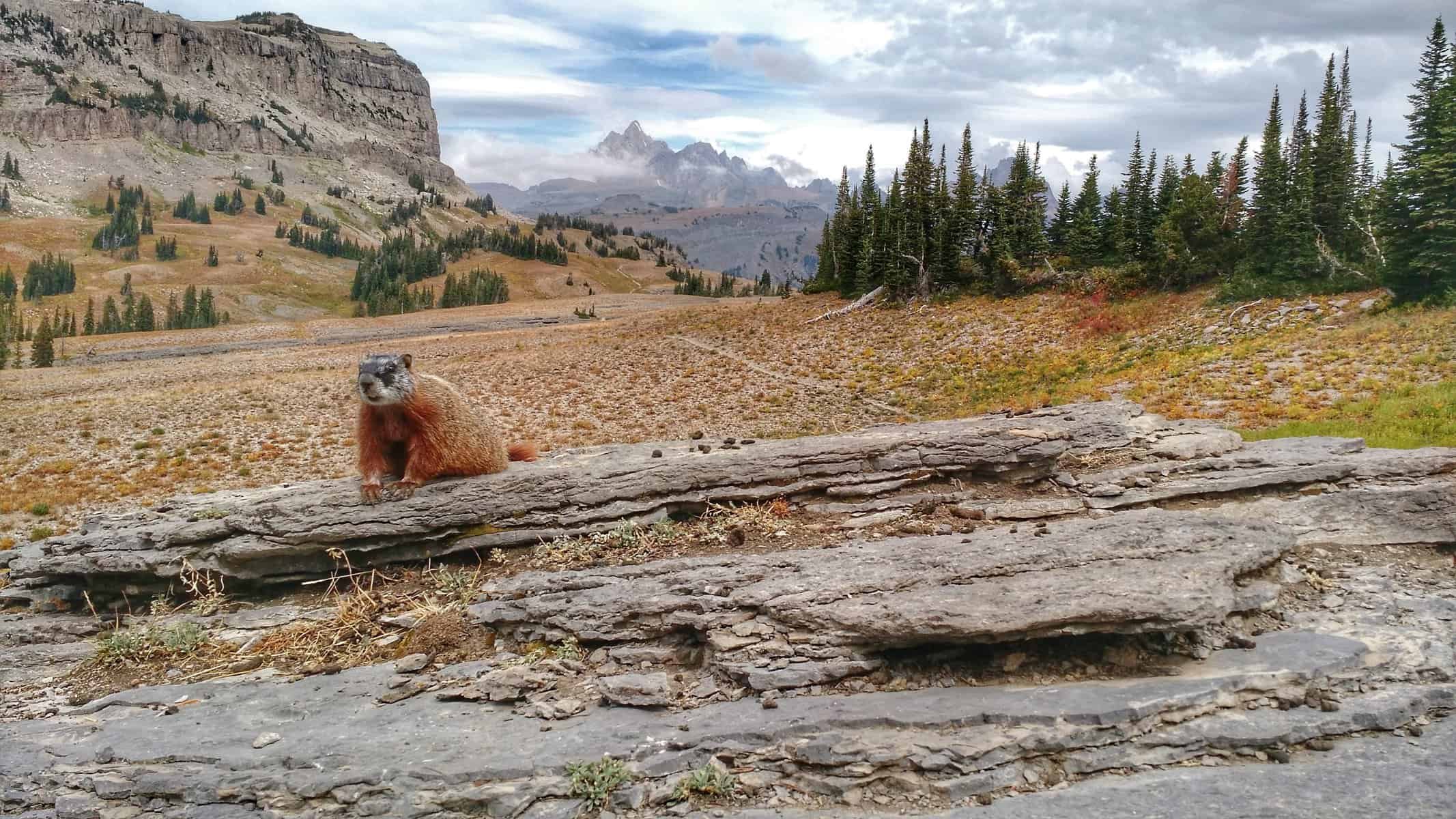
Day 1: Mr. Marmot hanging out watching hikers go by on Death Canyon Shelf.
Before I knew much about this route, or that it had an official name, I fantasized for a year and a half about hiking the full Teton Range from either direction. “I would need someone to go with. And I would need a lot of hiking experience before I took on an endeavor like this.” I thought. Just a year ago, I wouldn’t have fathomed doing this trip this soon, let alone believed I could do it solo.
Above Schoolroom Glacier on Hurricane Pass — Day 2
But I did. 80 miles, 4 days, 3 nights, a lightweight pack with a base weight under 15 pounds and a total starting pack weight, including the clothes on my back, at 33 pounds. I started from the Teton Pass at the Philips Canyon trailhead and ended at the South Boone trailhead. Other options include starting or exiting via Lake of the Woods, Berry Creek, and Coal Creek. Because of the different options, there have been various names to this route including Teton High Route and Teton High Adventure Traverse. I chose to end my route through South Boone to avoid bushwacking to Lake of the Woods, as walking 6 miles through some of the most prime grizzly country in the area, by myself, in the evening after already hiking 70+ miles didn’t seem appealing. The “official” North Teton Crest trail 008, drops into Berry Creek in Grand Teton National Park. Choosing this route would have involved a much longer shuttle and this year been completely impossible due to the fire which burned almost 21,000 acres in that area.
WHERE I CAME FROM (MENTALLY)
Day 1: setting out on Philips Canyon trail, contemplating the unknowns ahead and if I was prepared to take them on.
I already shared that a year ago I wouldn’t have fathomed doing something like this alone — it was only this Spring that I did my first solo backpacking trip, which resulted in one fear-facing adventure. This trip would technically be my fourth, but the longest trip I’ve ever done on foot.
Last winter I was talking with a guy at a sandwich shop in Jackson about backpacking the Wind River Range (still high on my list). He talked about his week-long solo trips through there and I couldn’t imagine doing something like that solo. The Winds are not something to mess with, but nor are the Tetons.
As my good friend Eric Morton (Epic Tour) once said:
“Of all the mountains I’ve seen, the Tetons are the ones that look like they want to rip your head off, but then cuddle with you afterward because they feel bad.”
Day 2: I got to cuddle with some of these rocks as I traversed this technical scree field slide, grabbing for any rock that would hold and not pull loose and roll hundreds of feet.
It’s true. So what happened mentally for me that made me believe I could do this… alone?! I honestly don’t know. Perhaps it was the adventures of a few solo overnight bikepacking and backpacking trips in combination with leading my dad and brother on their first overnight backpacking excursion. But there are a lot of people who are much more accredited than I am who think what I did in the allocated time was crazy. Was I simply naive? Overconfident? I don’t feel so… I was pretty nervous, right up until I left the Teton Pass trailhead. And even then, I knew there were some sections I would have to get through that would be incredibly challenging, plus the weather wasn’t going to be exactly pleasant. I didn’t want to bail just because the conditions weren’t going to be perfect — what kind of an adventurer would I be if I only explored in guaranteed fair weather?
Woke up to this after the first night at Sunset Lake on the trail.
I had doubts. Lots of doubts. From what I read to what I heard people say, I began to question what I was going to do. Was I ignorant to think I could backpack 80 miles of the Tetons in 4 days, given the terrain? I justified my ambitions, “I hiked the Grand Canyon rim to rim to rim (48 miles) in two days, surely I could do 80 in four!”
I confided in my good friend, Jordan, who is an experienced ultralight backpacker: “There’s a difference between crazy and stupid,” as I contemplated my timeline. It’s one thing to do what people think is crazy, but it’s another to be just plain stupid about it. I decided to carry through with my intended timeline and itinerary, trusting in what I’ve learned over the past few years.
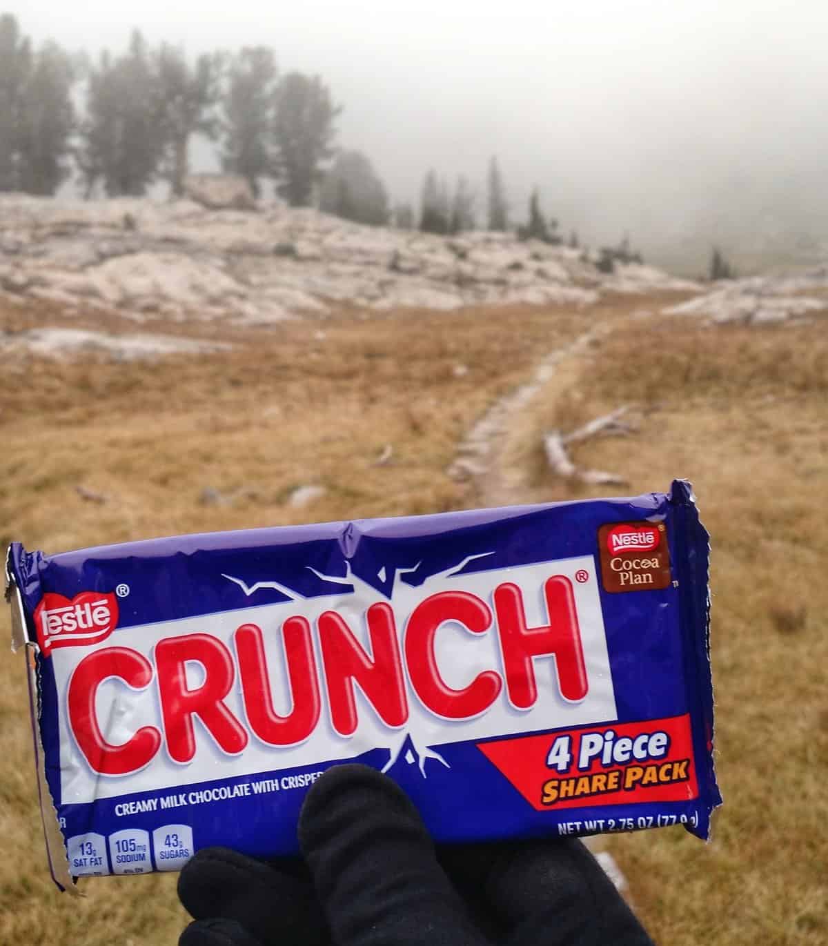
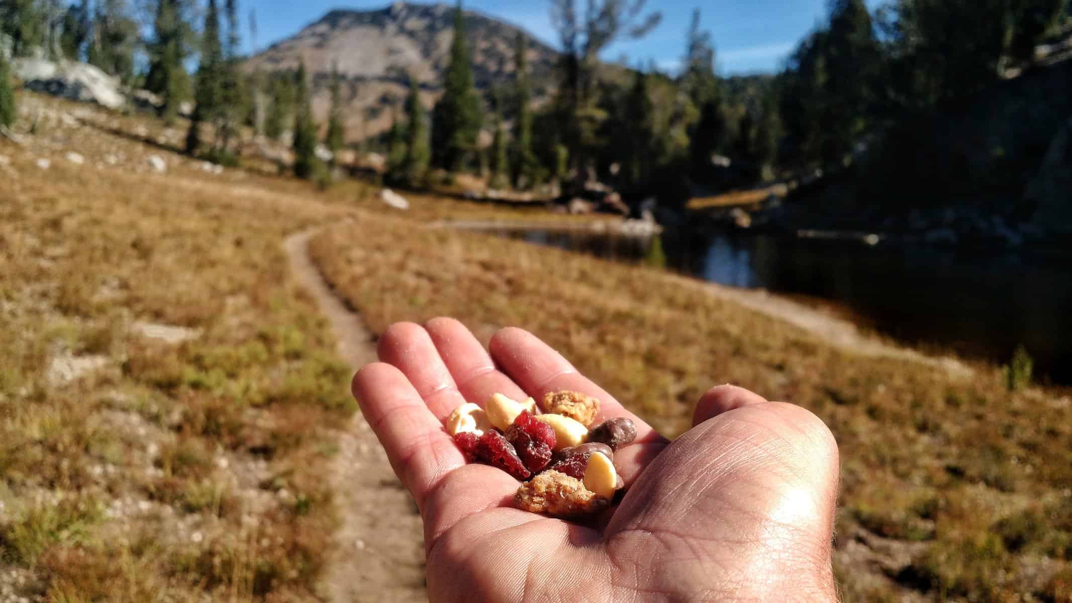
Nutrition is great. But there’s something chocolate can do for a mood boost in the backcountry! My buddy Jordan hooked me up with some snacks and meals. He included 4 large candy bars, which I shared with myself!
DAY ONE
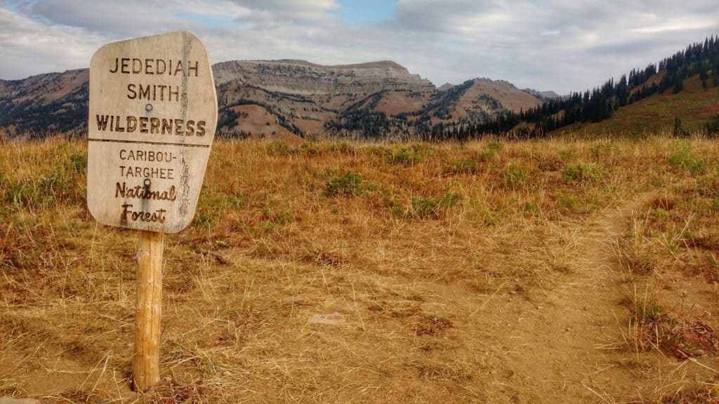
Day 1: Entering the Jedediah Smith Wilderness at Philips Pass.
A friend of mine, Becky, kindly offered to give me a ride to the Teton Pass trailhead at 7 AM Sunday Morning, September 4th. I had cell service for a little while, so I called my mom and let her know I was on the trail and would be away for 4 days — exactly what a mom wants to hear, right?! After hiking a few miles and getting close to Philips Pass, I came across 5 moose peeking above the fireweed — 2 bulls fairly close and three cows above them on a ridge. I was actually a bit nervous. At a safe distance, I kept walking the direction I needed to go without pushing their boundaries (or mine!)
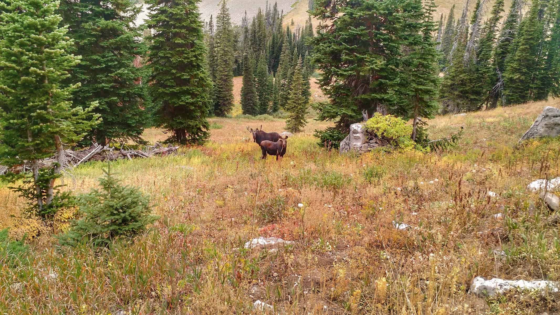
Two of the three moose in the second group I came upon only a few miles apart.
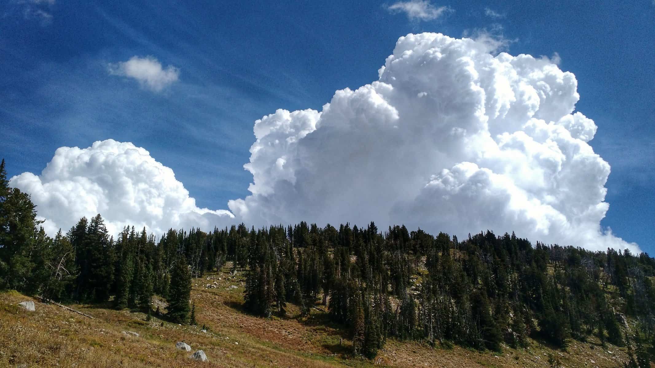
I saw three more moose — one bull and two cows — a while after, before crossing into Grand Teton National Park. It was about 11:30 AM at this time and the clouds were playing games with me. I was certainly expecting some mid-day weather, though unsure what and when it would actually rain. The trail passed through a large open grassy meadow, with Northern Harrier Hawks flying all about. Sprinkles of rain came but never stuck around long enough to justify throwing on the poncho.
Day 1 after crossing into Grand Teton National Park: Big thunderhead clouds looming over and passing through. They let down some sprinkles, but nothing serious.
It was at this point of crossing the trail junction with Rendezvous Mountain Trail that I began to come across other backpackers, most or all who came up the tram. Personally, I can’t relate to going on a multi-day backpacking trip, but getting a ride up to the top of the mountain — huh?! For me, the longer I walk, the more comfortable I get. Pains on the first day, disappear the next. Sure I get sore in some places, but in being in tune with my body, I can improve my experience and make the needed adjustments keep those sore areas from turning into stressed muscles and blisters.
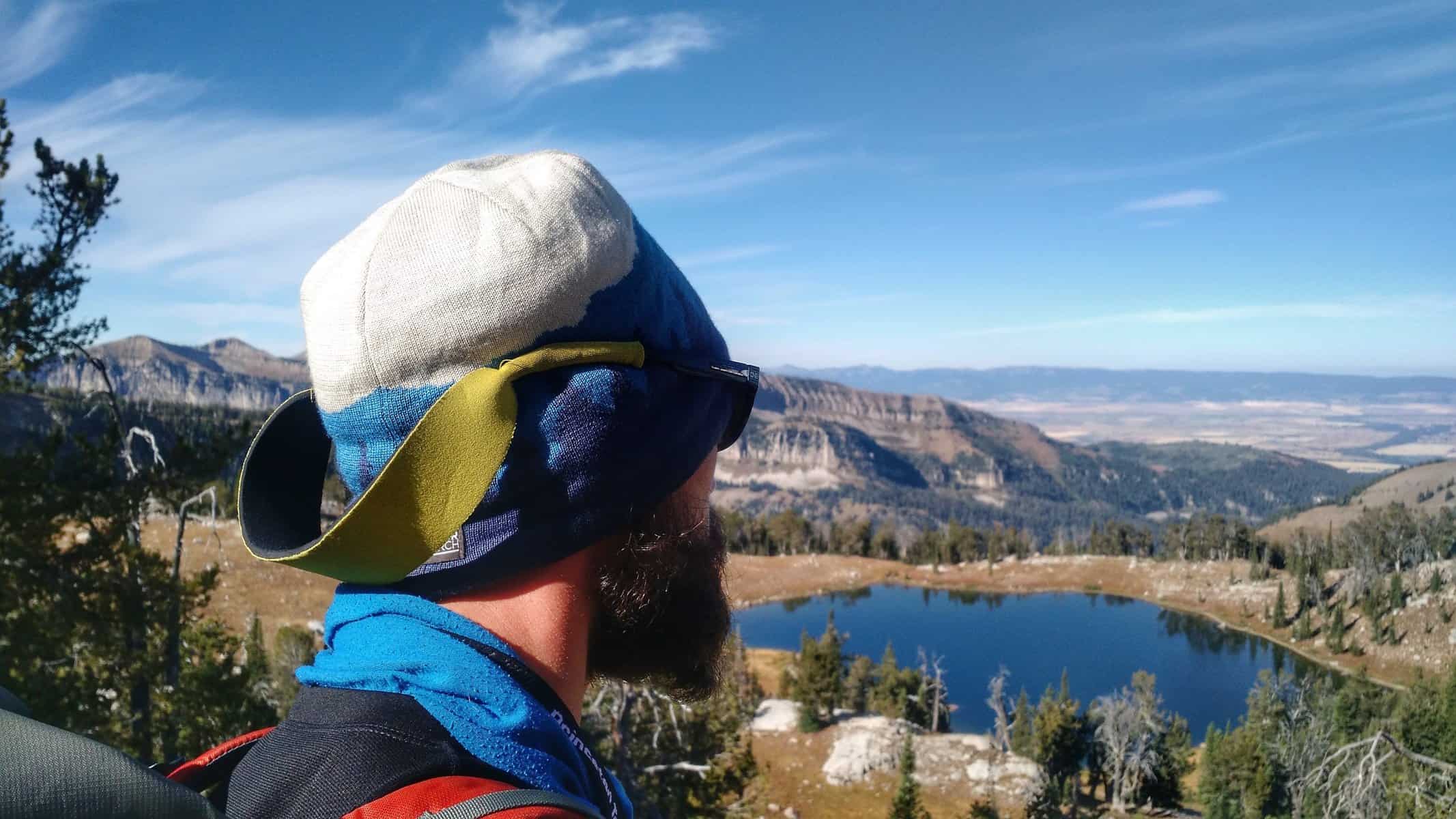
Day 1: Marion Lake after walking past it and having lunch and conversation with some fellow hikers.
I arrived at Marion Lake at mile 11.5 and took my first real break of the day. It was around 1:30, so I stopped and had lunch, though I contemplated that given I still had another 10 miles to go. It was really the best place to stop as the weather became questionable later on. I visited with some folks — a girl who was on her first backpacking trip, doing a 4 night, 5-day stint in the Tetons, which I deemed a pretty impressive goal! But she was loaded down. It pained me just looking at the pack and big leather boots she had on. “Everything you need is in there?!”, she asked referring to my pack. I offered some tips to think about how to lighten up her pack for her next trip and recommended she check out Mike Clelland’s ultralight backpacking book — you all should too! While eating lunch, a couple of other girls having lunch nearby, and who actually worked in Grand Teton National Park, spotted some big horn sheep traversing the steep rocky cliff ledges.
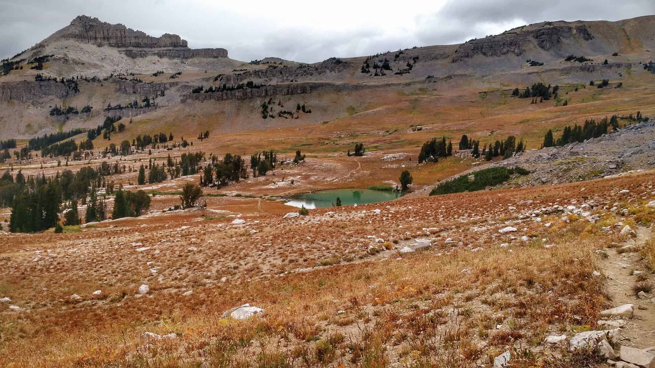
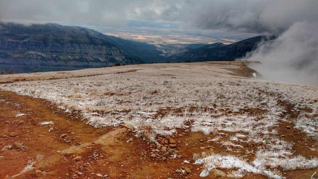
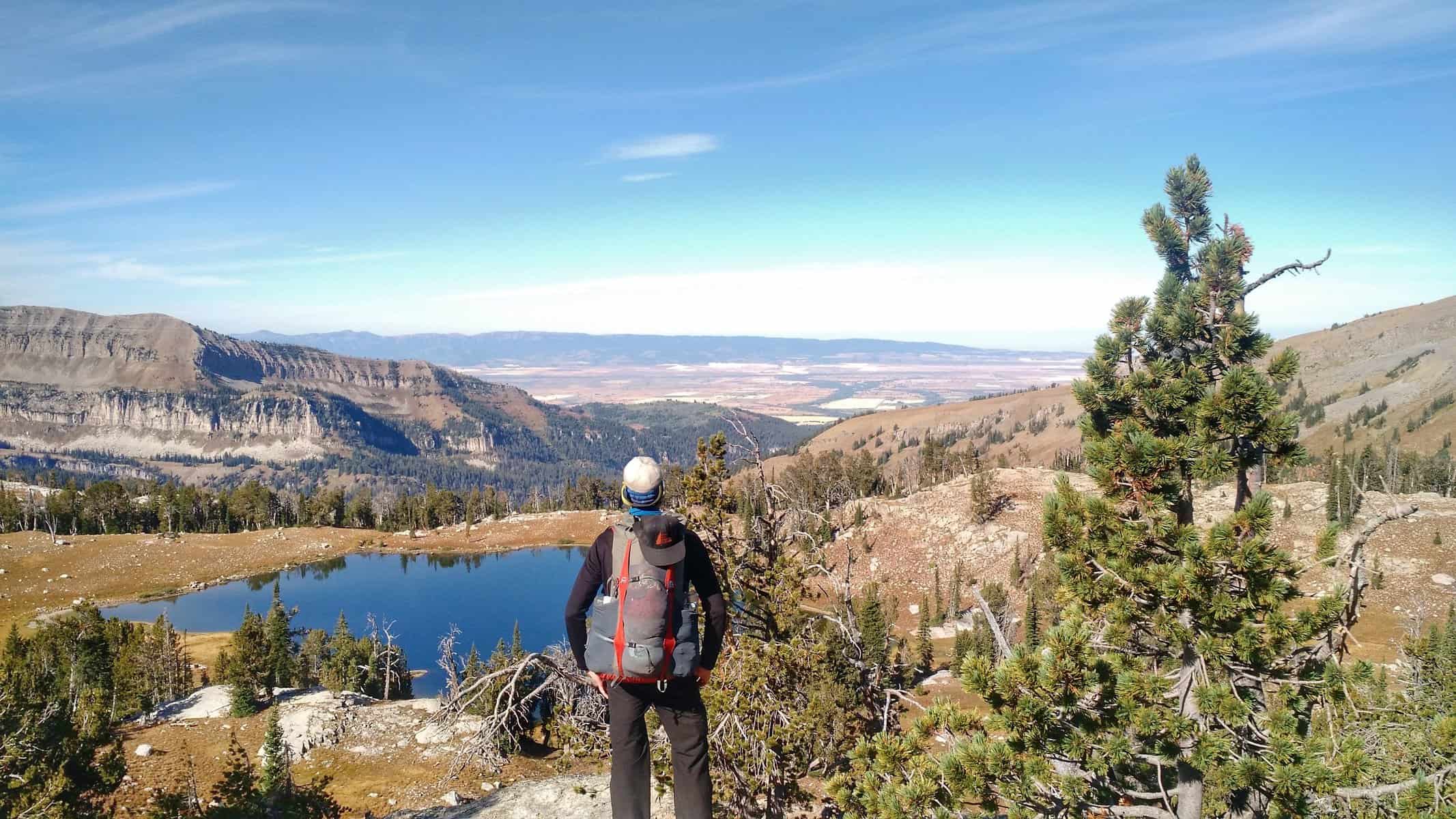
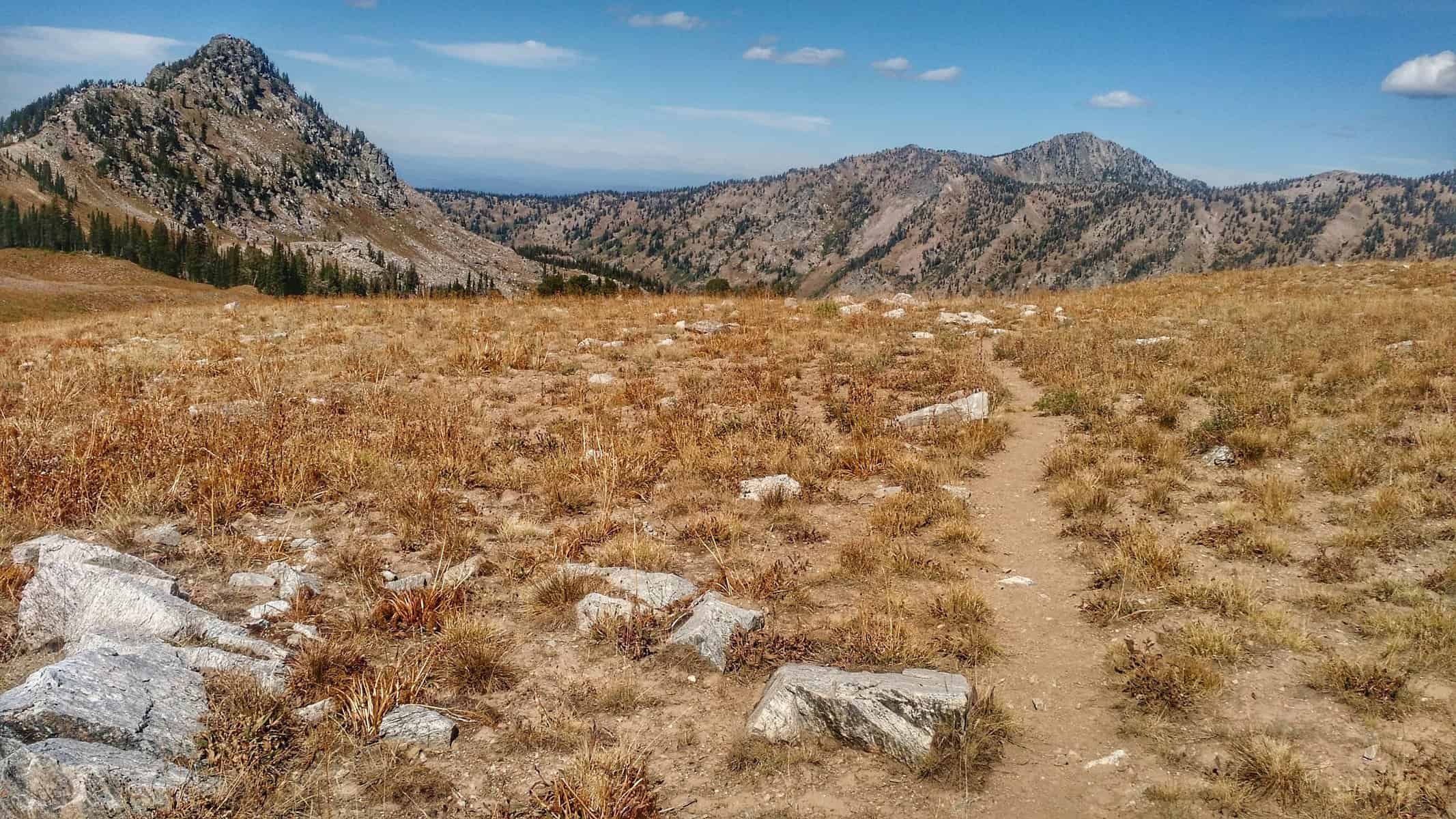
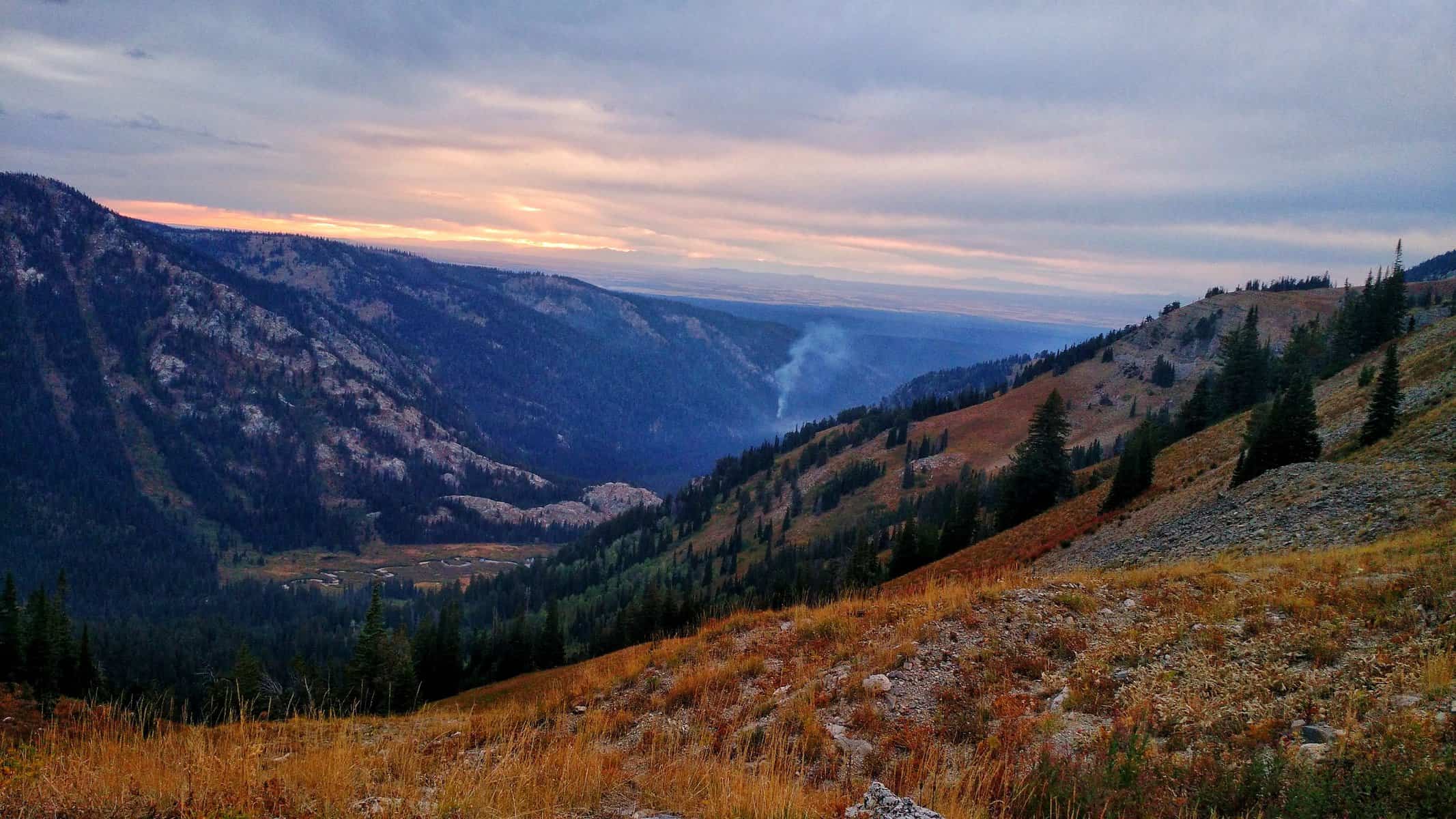
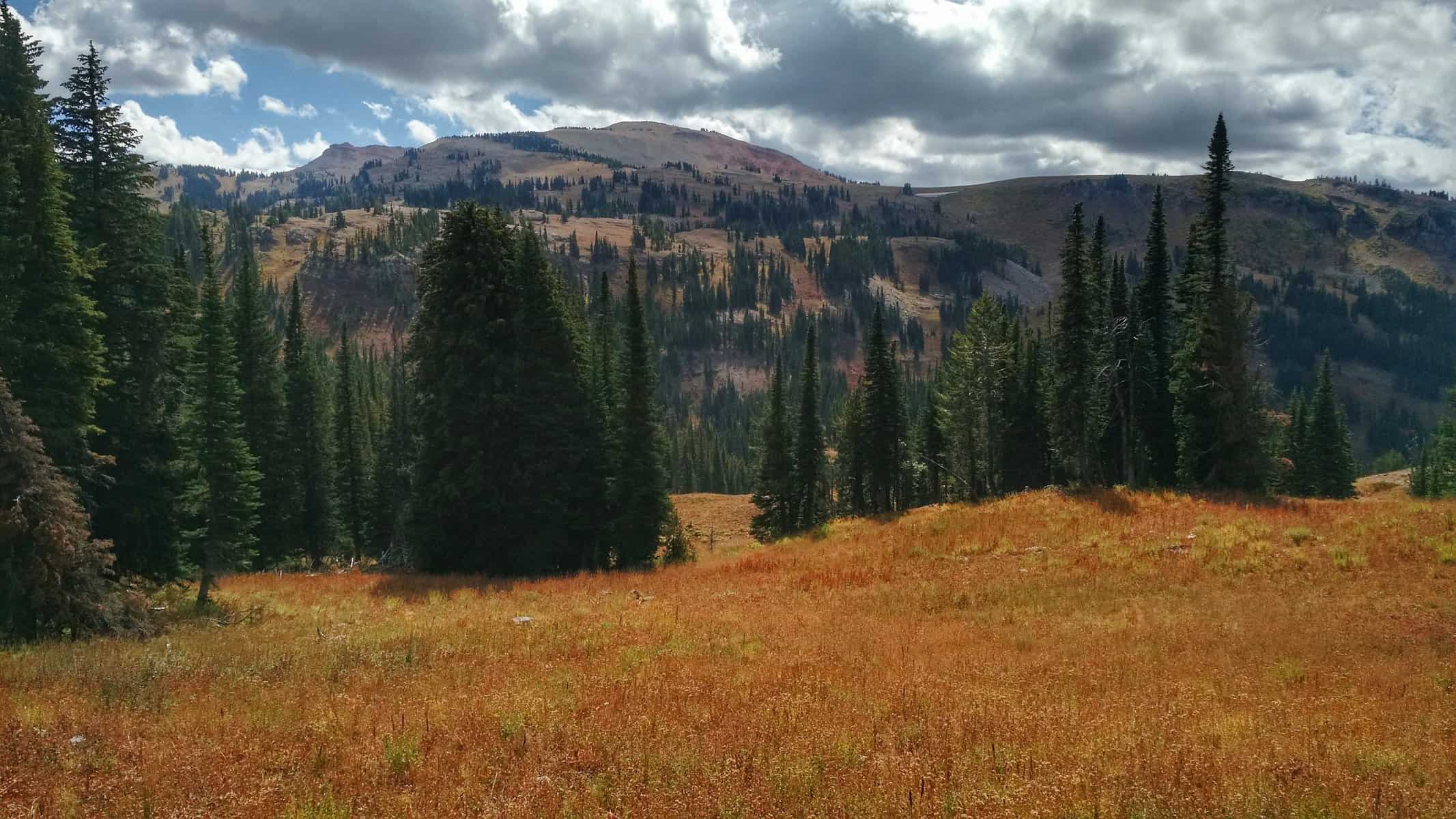
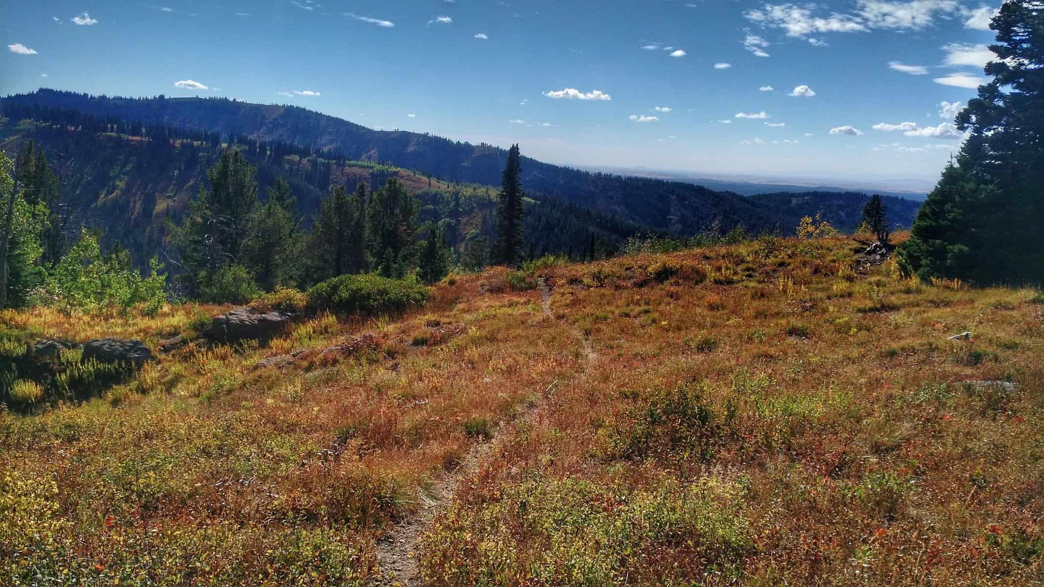
Day 1: Looking towards Death Canyon Shelf
Death Canyon Shelf was the next major destination. It was here that the Tetons came into view, though they often hid behind a curtain of clouds. Eventually, enough clouds moved in that most views were obscured. I wouldn’t see the Tetons for quite some time after that. I met a guy from Bulgaria (if I remember correctly), but now lives in Florida and hadn’t done much backpacking lately.
Day 1: Hiking into Alaska Basin.
As we hiked through Alaska Basin, he told me all about these amazing places to visit in Europe, specifically the Swiss Alps. I pulled away a bit from him, but as I was climbing up yet another pass, he shouted up to me “Good luck! Nice meeting you!” and I returned the greeting. If only you could reconnect with these people to hear the account of how their trip went.
Day 1: From the pass I talked to my fellow hiker from below me. The fog in Alaska Basin changed it since I had remembered it last, making for a completely different experience.
21 miles in for the day, I made it to Sunset Lake by 5:30, which was about right on time. However, I had initially planned to continue past the lake up Hurricane Pass, across the boulder fields and scree slides to the south slope of Table Mountain, which I’d then hike up to and camp a mile or so down from the summit on the ridge.
Day 1: Coming into Sunset Lake
But I was uncertain how long it’d take me. There were a lot of variables. The questionable weather loomed over and the fog was still pretty thick. I felt after such a long day, I would rather just set up camp, eat dinner, visit a little with some backpackers camping nearby and get a good night’s sleep.
Day 1: thinking back on the terrain and conditions like this in Alaska Basin made me opt to not go forward up Hurricane Pass to Table Mountain this evening.
It was much needed and such a good call. That night not only did I need the sleep and extra time, but storms blew in with rain/sleet combo turning into snow and some pretty close lightning strikes. I was glad I wasn’t on an exposed ridge and that I didn’t push myself up against the clock on terrain that I wasn’t familiar with after already hiking 21 miles that day.
MORE PHOTOS FROM DAY ONE
[slideshow_deploy id=’796′]
DAY TWO
Day 2: Morning at camp at Sunset Lake.
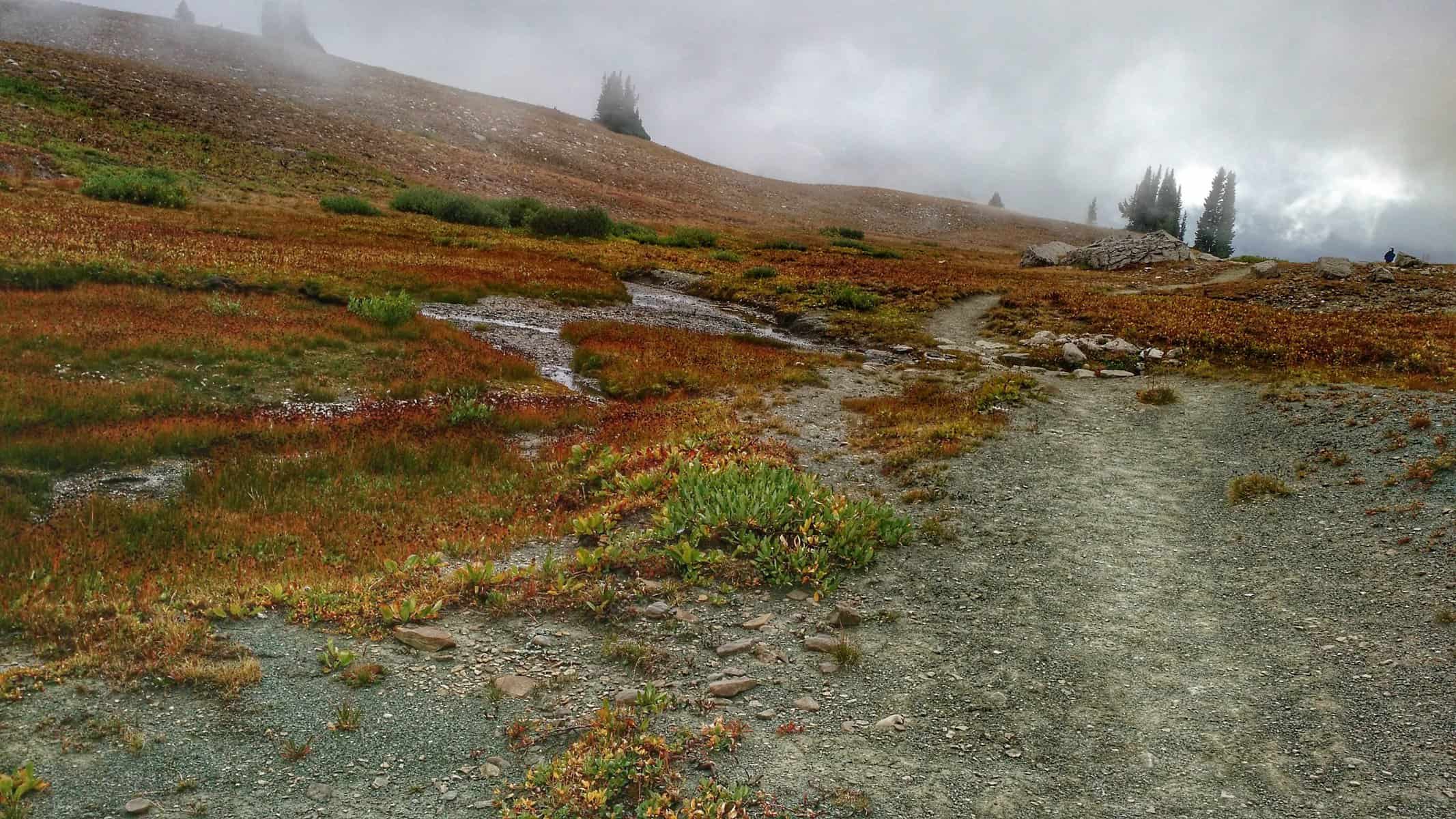
The next morning I woke up around 5 AM to a bunch of snow and thick fog. I didn’t feel like getting up. My body wanted more sleep, given that I really hadn’t gotten much sleep the night before my hike. I decided I’d sleep for another hour. I slept for 2. Woke up at 7:30. LATE! I had a big day ahead. But I’m notoriously slow in the morning and didn’t get moving on the trail until 9:30. Part of that procrastination was in hope that the fog would clear. No such luck.
Day 2: Hiking up Hurricane Pass and looking back towards Sunset Lake in the distance.
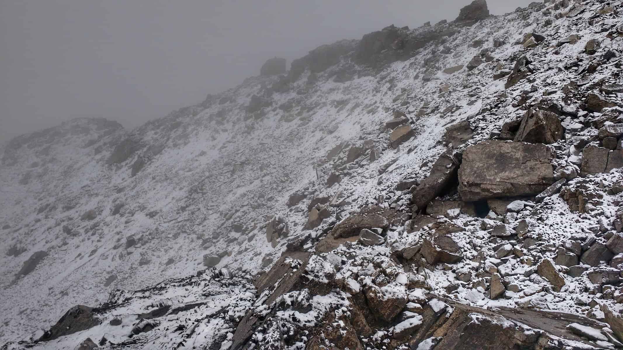
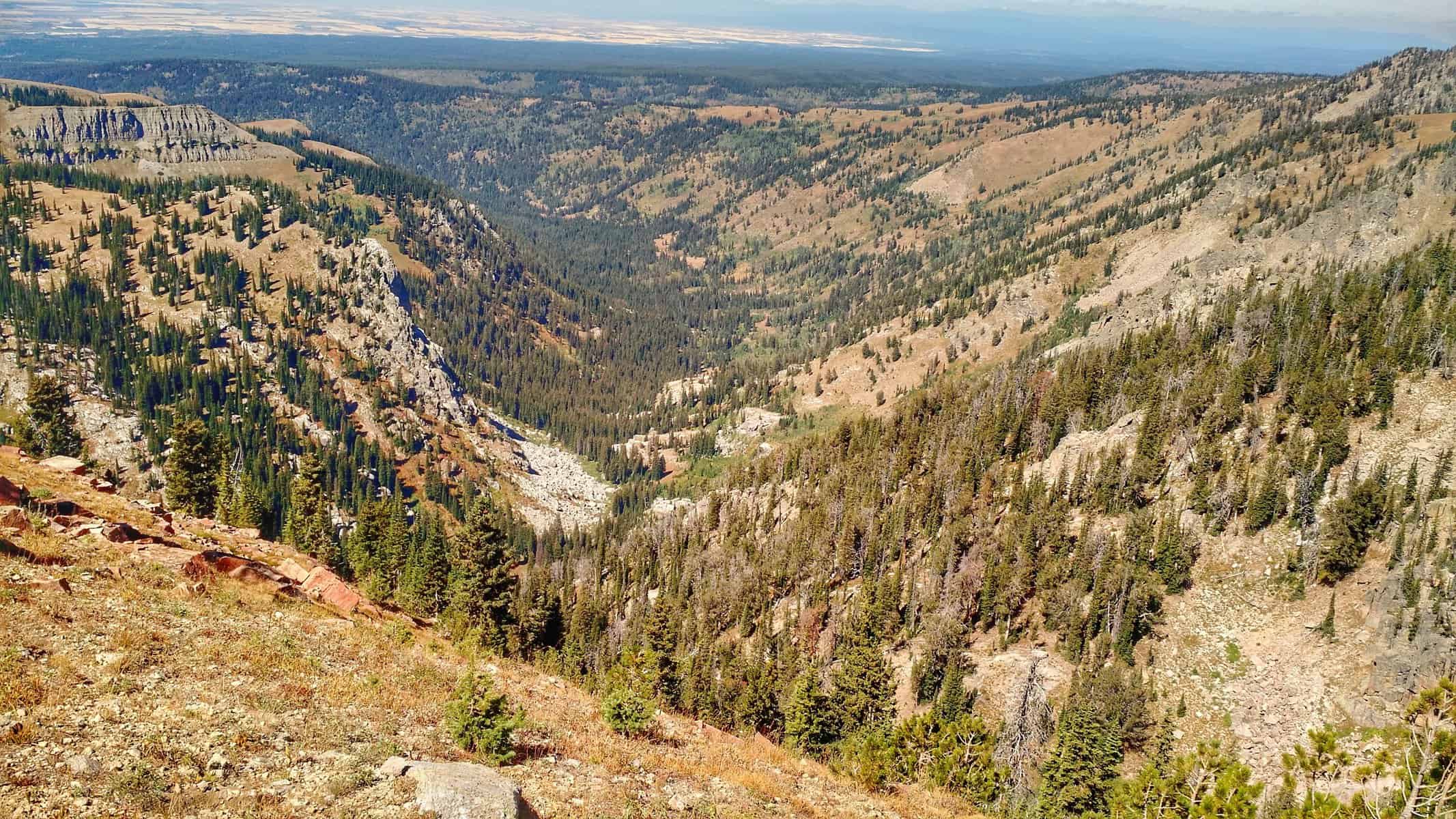
At the top of Hurricane Pass, it was icy and snowy, giving me a glimpse at what I will be facing for the next two and a half hours. Looking down to the east I saw Schoolroom glacier and Cascade Canyon in the distance with the sun breaking through the dramatic clouds. Despite the scene, the Teton peaks were all hidden. As the trail turned to drop down into the South Fork of Cascade Canyon, I continued straight. Initially, there was a little trail to follow, but it quickly transitioned into to boulders, scree, and short scrambles for a mile and a half.
Day 2: Still on trail on Hurricane Pass, but you can see where one trail bends to the right and another faintly goes straight along the spine — this was the one I followed.
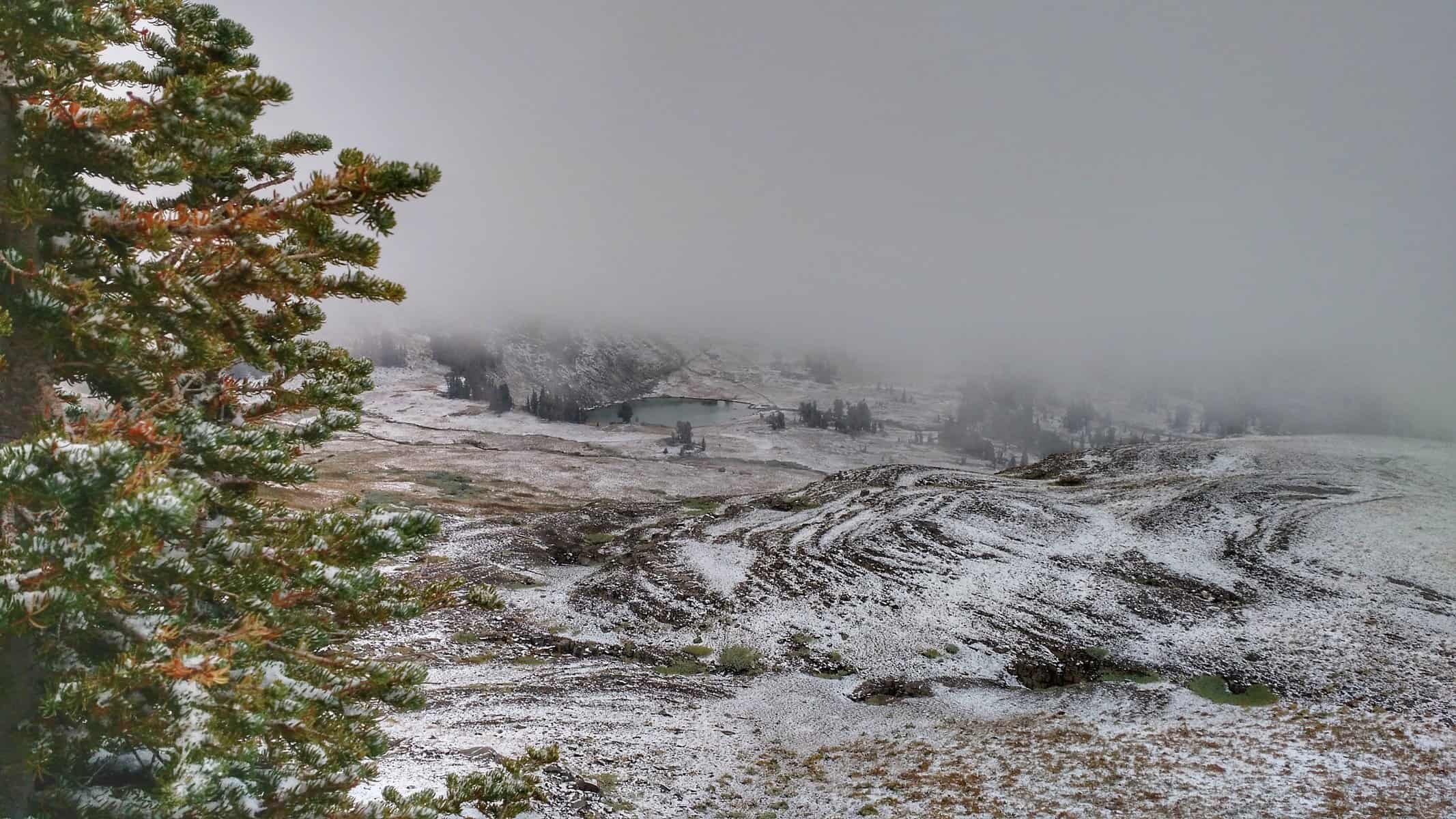
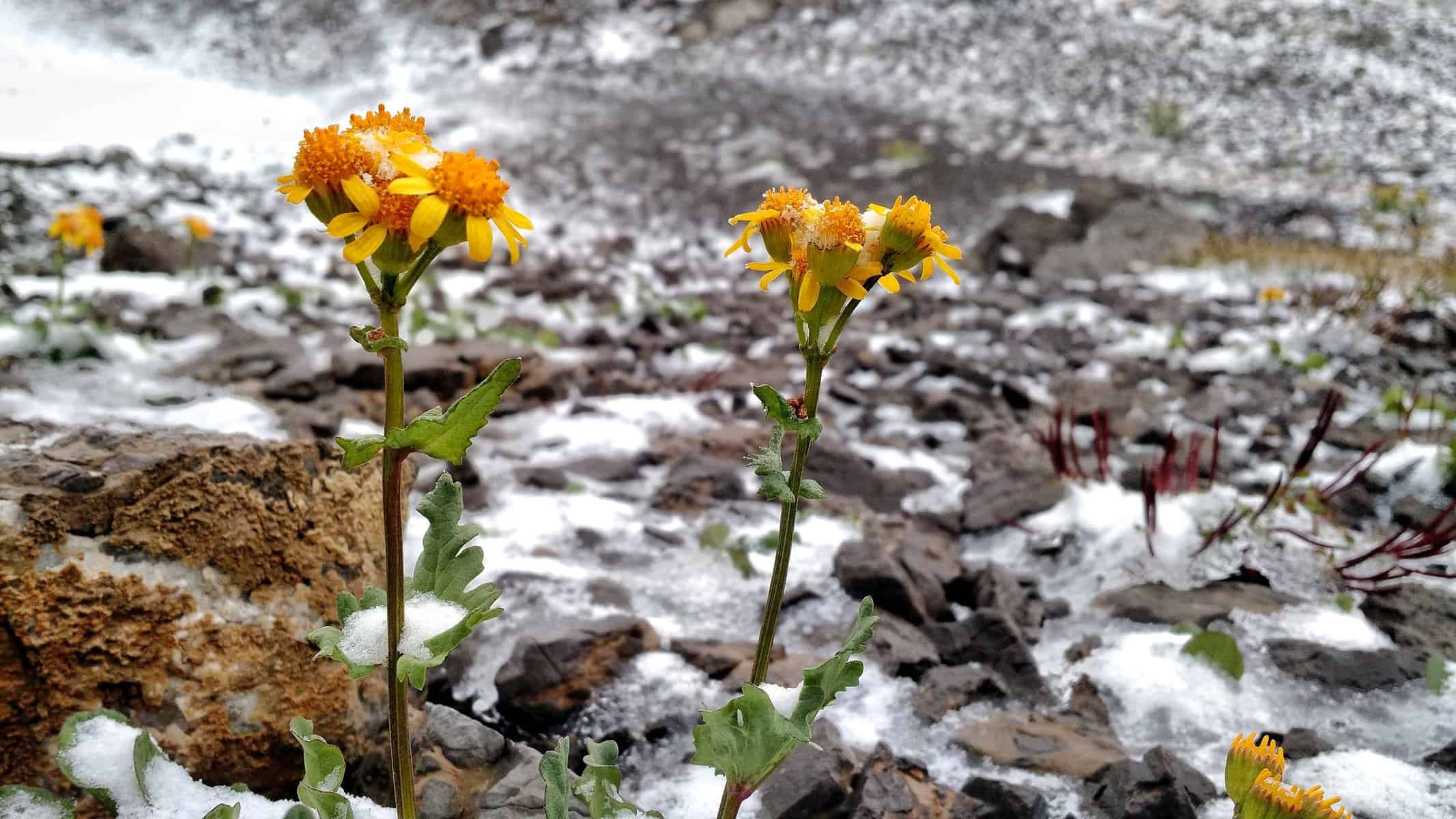
There wasn’t often much opportunity to stop and take photos. And the ones I did take didn’t seem to offer much — fog obscured any scenery and points of reference. But I did enjoy the contrast between alpine wildflowers hanging on, despite the recent snow and ice storm that blew through.
I’m a sucker for contrast.
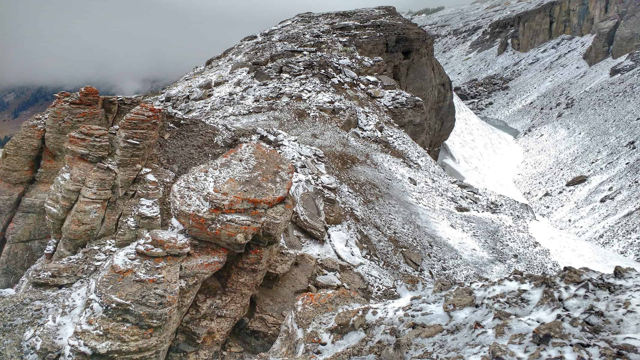
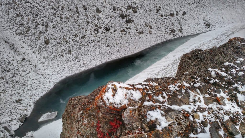
With the ice making it even more challenging and the fog blocking Table Mountain, I kept checking to ensure I was on the right route. At one point, the route showed me following where an angled snowfield was. I was on a rock ledge above it. The snow seemed manageable, but with a small glacier at the bottom, I remained on guard. I scrambled down a rock chute and jumped across a gap onto the snow.
The terrain I was traversing. Notice the snowfield and glacier to the right, which is what I attempted to walk on.
Looking down onto the glacier from the rocks above.
After taking two steps, I slipped and quickly grabbed the edge of the snow where it had receded from the rock. Nope! Not doing this. I don’t know if I fully comprehend the severity of this situation, should I have not caught myself, kept sliding and fallen into the glacier. From that time on, I wasn’t going to push the envelope and only base my judgment off of a single line on a map anymore. It was a good lesson in interpreting terrain and going with your gut, personal experience, and available equipment.
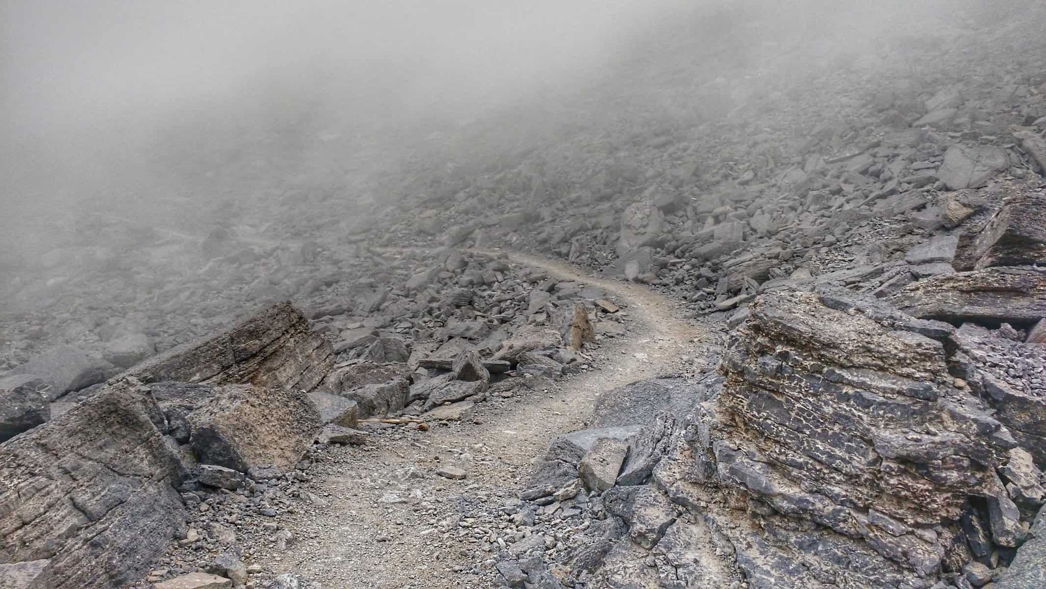
Loose rock scree… the trail is there. See it? Nope.
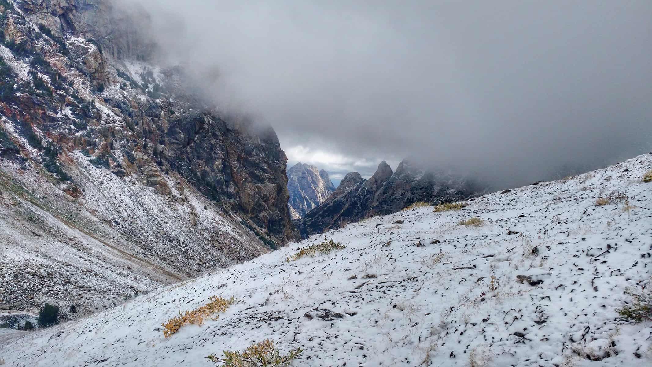
The challenging terrain continued as I slipped and scrambled for any traction climbing up the scree and steep talus. Atop the ridge, I looked down into Cascade Canyon to the east yet again. A view that was mostly congested by the fog. Regardless, I still felt like I earned it. The biggest challenge of the morning wasn’t over, though. I now had a half-mile, 1,000-foot climb up the south slope of Table. There is no trail, rocks can be loose and slick, and let’s throw some snow in the mix, just for fun.
Finally off the boulders and scree, walking downhill, a view of Cascade Canyon opens up again.
Part way up the south slope of Table Mountain, looking down at the hillside I came from.
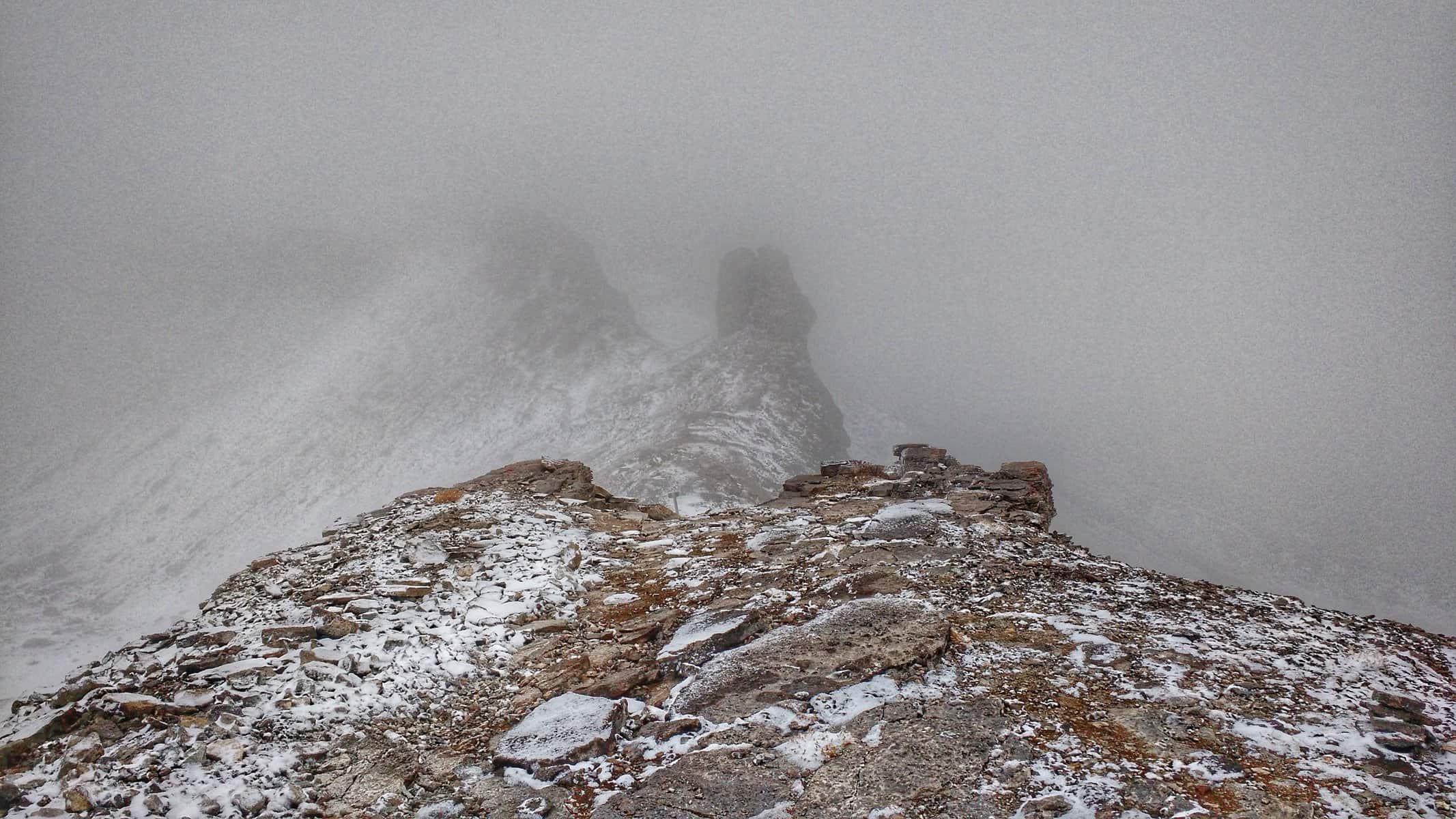
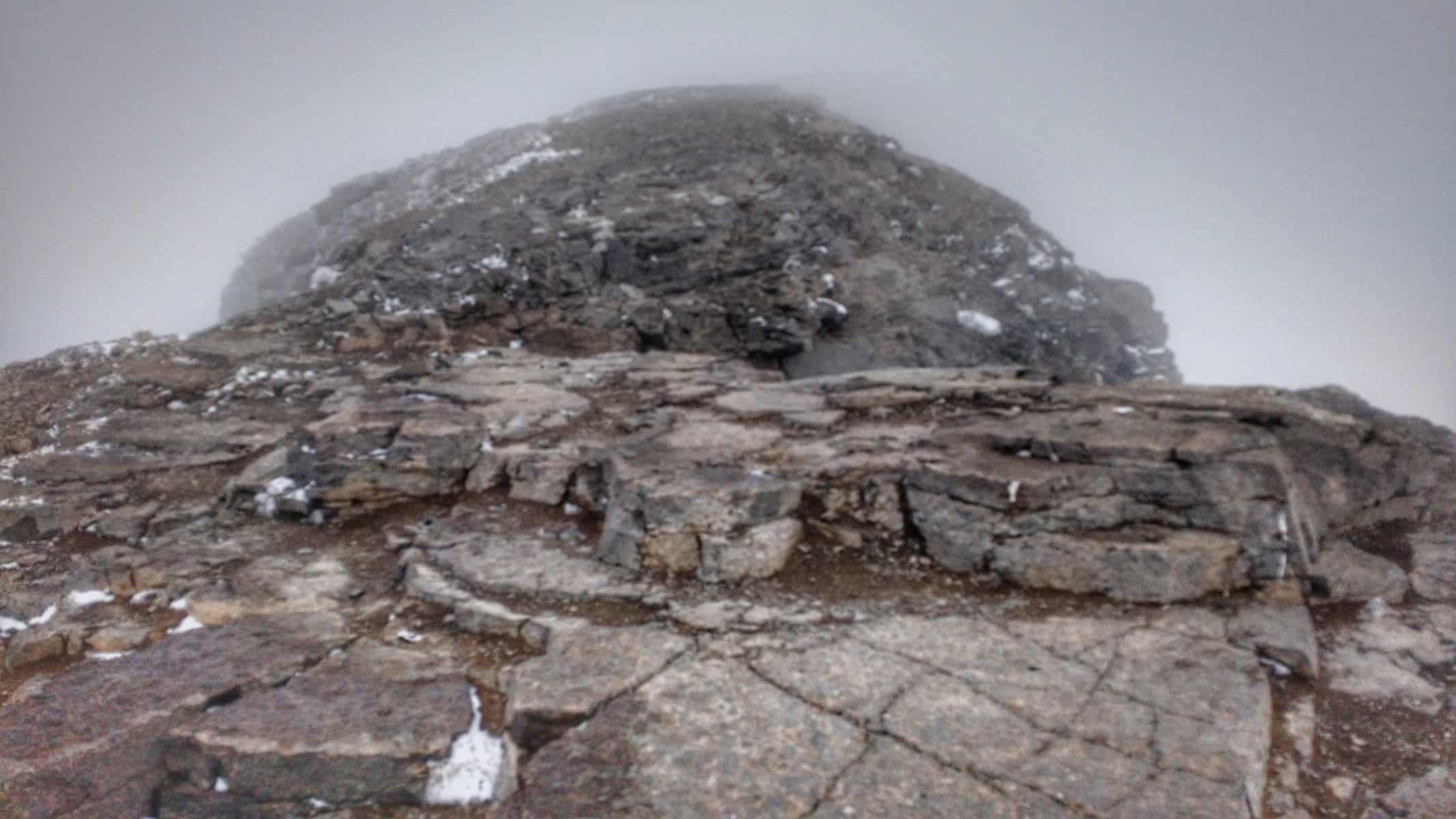
Eventually, I made it to the top of Table. It was 12:30 and I had the summit to myself, though I encountered some people coming down from the top. No views. Whatsoever. If this had been my first time on the summit, it would be pretty disheartening, but I have a feeling I would have waited it out. Once in a while, clouds did seem to suddenly clear with a gust of wind. In fact, this happened as I was heading down the Face Trail, revealing Teton Valley in the distance.
Table Mountain summit — no Tetons in sight.
I met some more folks about a half mile down from the summit. Nice people, though I couldn’t help but be slightly annoyed by the question “How much further to the top?” Given what I just went through and that regardless of my answer, they would still continue to the summit, I didn’t know how to reply.
Descending the Face Trail from the Table Mountain summit. The fog randomly cleared revealing dramatic views of Teton Valley.
“Not much further, but at least you have a trail.” We talked for a little longer and I told them where I had just come from. This would be my last quality human interaction for the remainder of the trip. I had a lot of time to make up, and thankfully, not many day hikers are really interested in talking, even when you have an abnormally large pack for the task that most people consider an “out-and-back” trail and not one you would thru hike. I took a long lunch around 2. I really hadn’t stopped moving since 9:30, so it was much-needed. My last human interaction for the trip was there at the creek as I filtered water, changed clothes and snacked.
Looking back towards Table Mountain from the North Fork Teton Canyon trail.
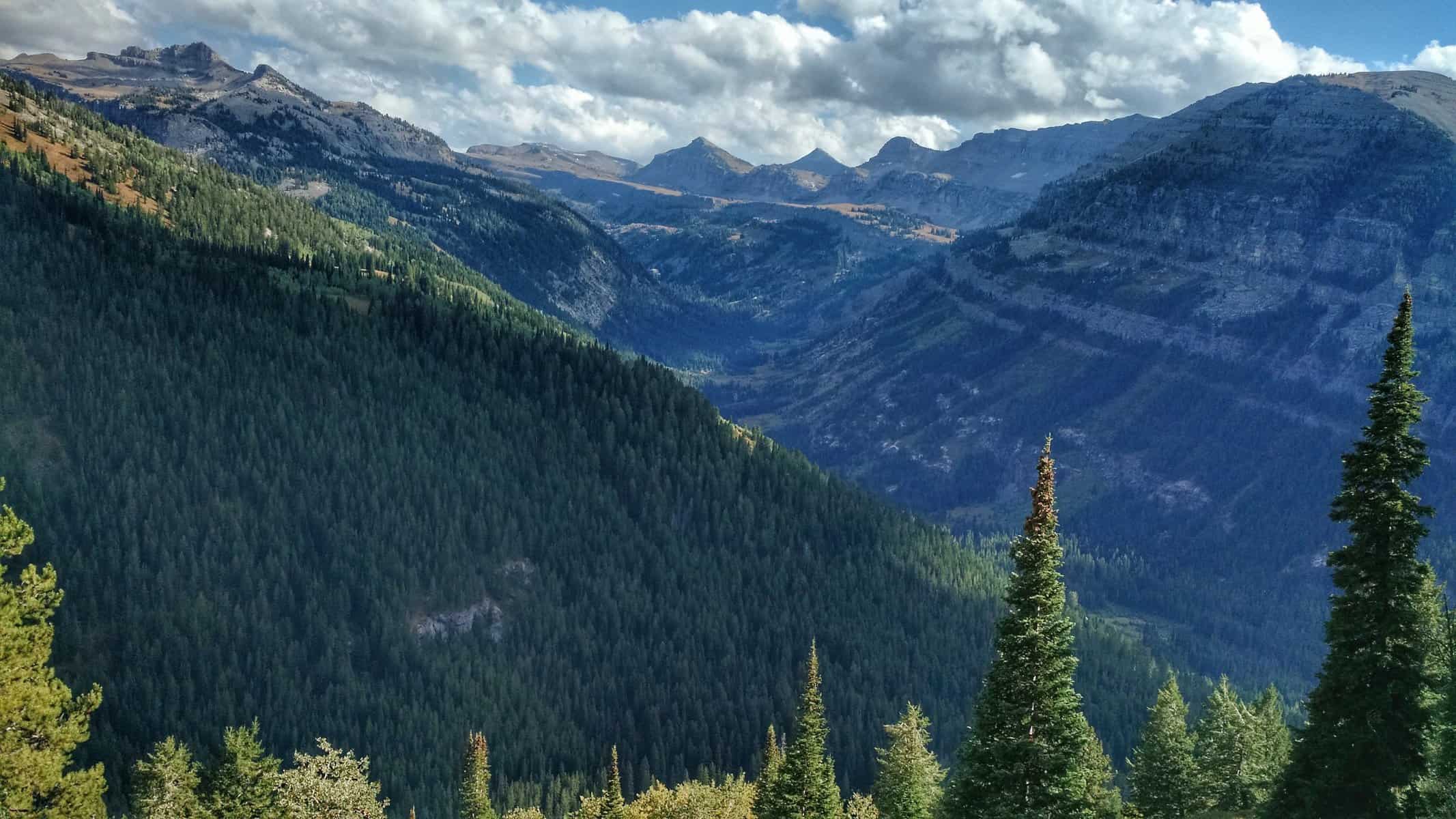
From the Beard’s Wheatfield trail, looking into the South Fork of Teton Canyon.
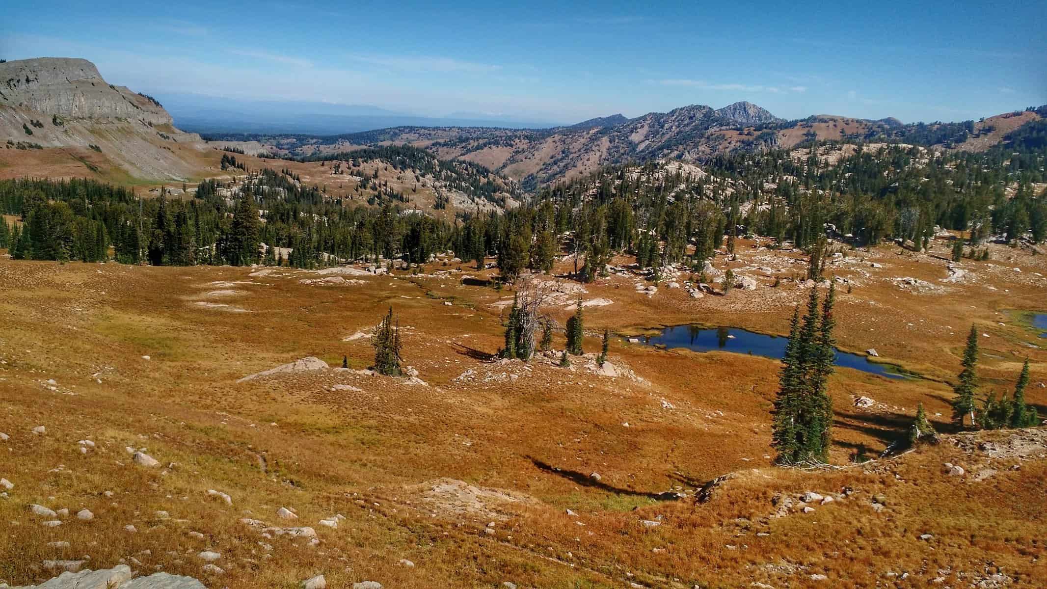
The junction with Beard Wheatfield’s trail eventually came. The leisurely downhill walk was over, but the climb back up resulted in some incredible views of the South Fork of Teton Canyon and eventually the Grand. At the top of the climb was the junction with Fred’s Mountain trail, but I veered to the Northeast, dropping back down onto desolate, alpine desert terrain. Aside from some sparse trees, there was nothing but small flowers and crushed granite. The terrain changed yet again. I lost the trail a few times, but nothing that slowed down my pace.
Atop the Beard’s Wheatfield trail at the junction with Fred’s Mountain.
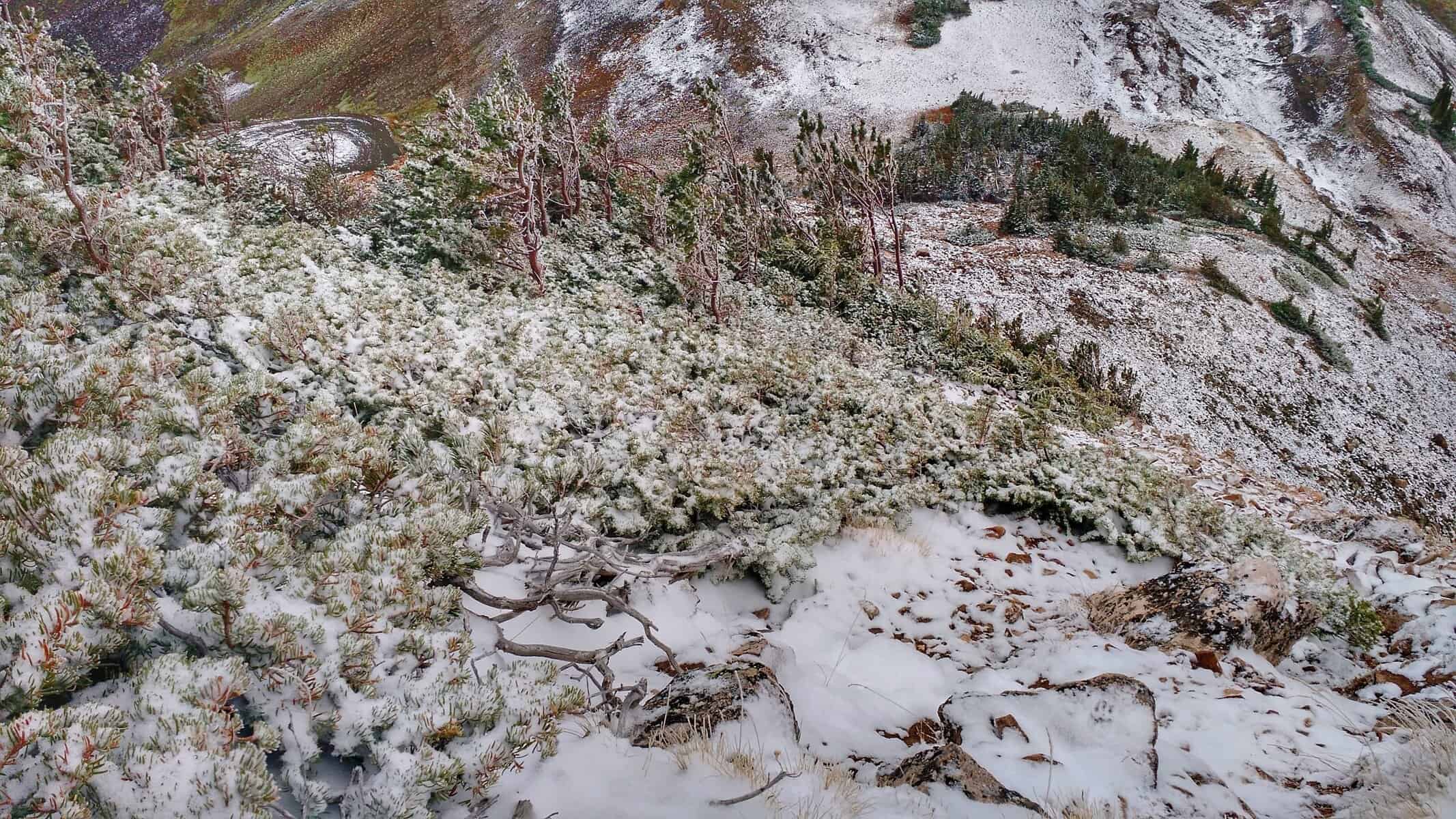
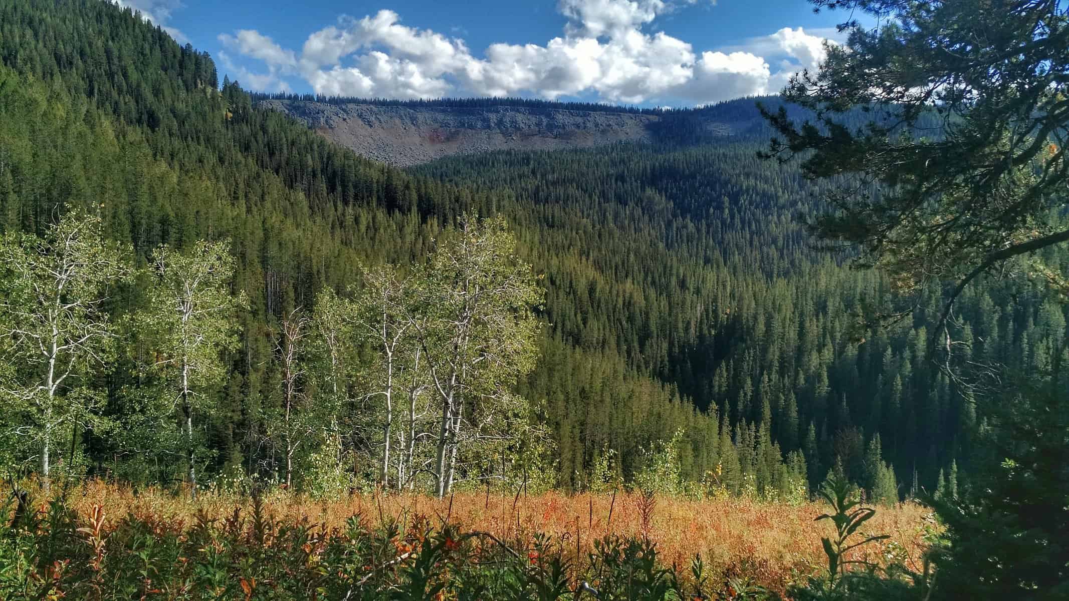
Dropping into South Leigh Canyon, the terrain quickly changed from open vastness of rock to thick foliage and lush moss. I eagerly awaited the sound of water, but upon arriving at the wide stream crossing, it was only a rocky bottom where water once flowed. At the next trail junction where I would head straight up the canyon, I had this hope that I would see someone again since I was in a slightly more traveled place. I saw a lot of horse prints, but upon seeing several piles of bear scat, I realized that there are probably more bears than people in the area right now.
It was 6:30. I had just under an hour and a half of daylight. I wouldn’t be making my planned arrival into Granite Basin for night 2, but I could cover as much ground with the light I had left to get as close to it as I could. First, water. I wasn’t sure how much would be available the higher I climbed and needed some extra for cooking dinner. A mile or so up the canyon I crossed some water on the trail, then I heard some off in the distance. I bushwacked to the creek — it was still pretty high here. Kind of amazing how it just disappears, dry as a bone, a mile or so downstream. With full bottles of water, I headed back to the trail and didn’t stop climbing or walking until dark. I averaged around 3 miles/hour during that time and passed several great “hammock” spots. It was hard to keep walking, wondering if I’d find a spot just as good as that, but I did. And with a pretty nice view of the Grand too!
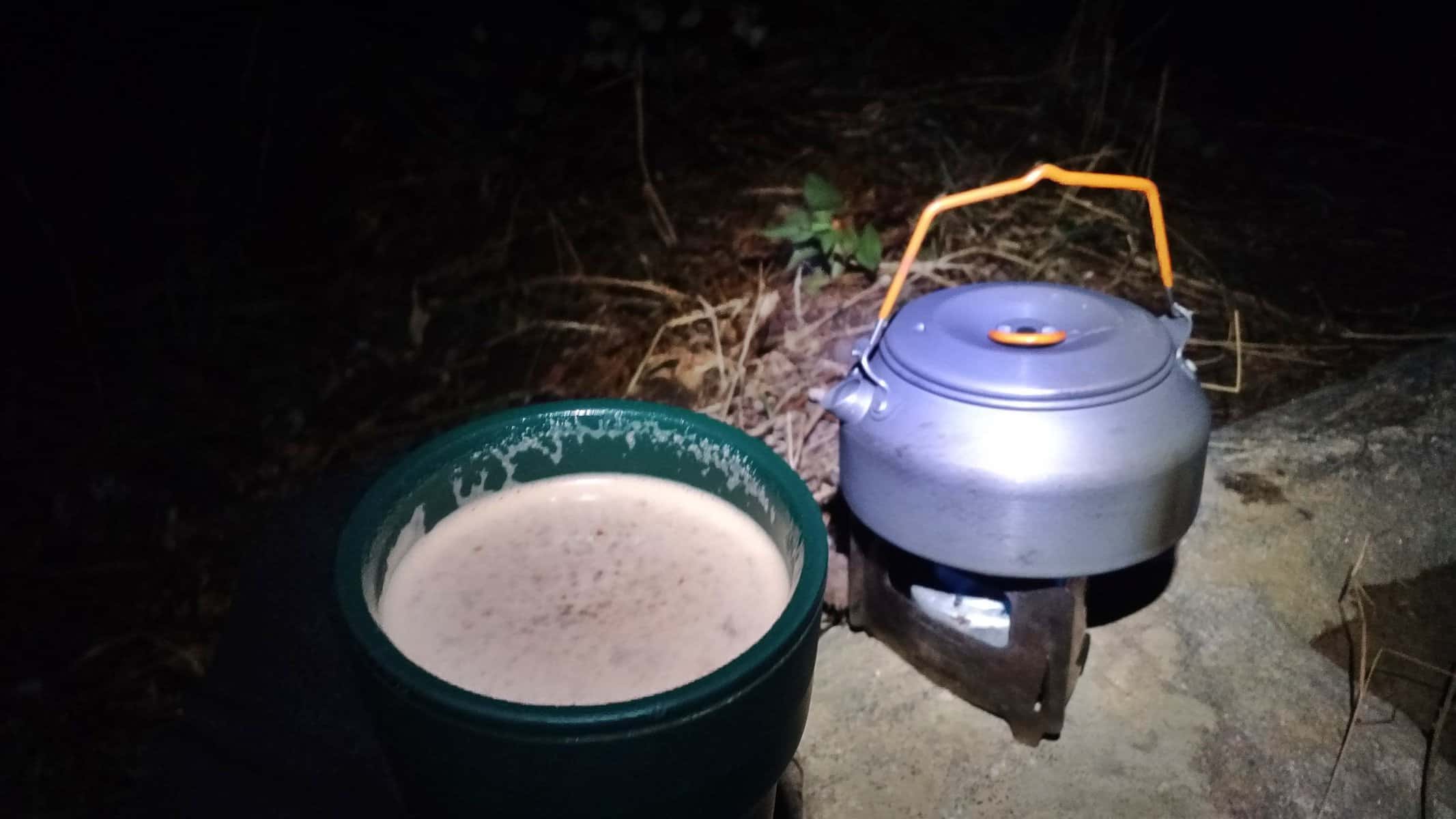
Hot cocoa for dessert after a satisfying dinner.
I cooked dinner, hung my food bag… which was a more difficult process than I would have liked, and snuggled into my hammock, reflecting on the day and struggles I overcame. Night two of three. Two days and one more night to go — half way done!
MORE PHOTOS FROM DAY TWO
[slideshow_deploy id=’806′]
DAY THREE
Morning views from the hammock on day 3 with crisp morning area were rejuvenating and motivating to keep pushing on.
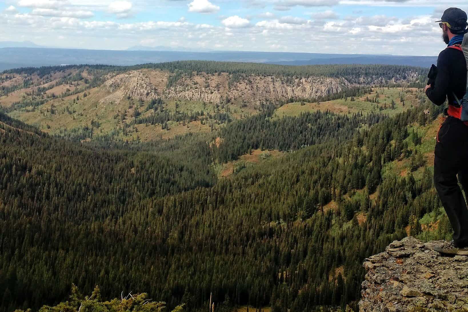
After walking a few miles from camp, I came into Granite Basin and the Green Lakes area — another destination checked off the list. This was where I was hoping to camp, and it would have without a doubt been an incredible place to wake up to. It may very well be one of my favorite places in the Tetons. The feeling of having all of this wilderness to yourself — being overwhelmed by the vastness, beauty and that you got yourself here on your own human power — is an experience I encourage all of you to pursue.
Day 3 in Granite Basin looking into Teton Valley.
As I entered the basin, I felt this “I made it!” feeling. Of course, I was far from the finish, but this was another area that I had long wanted to explore and I was going to get to walk clear through it! With spirits lifted, I took some photos to capture the mood and excitement. Five or six miles into the day, I stopped to have breakfast and filter water. I found more bear scat nearby, reminding me I was still not alone.
Dropping into the Green Lakes area.
The trail through the basin paralleled many of the lakes, crossed some streams and revealed huge views of Teton Valley to the west. It was a crisp, clear morning and I felt like I could hang out up there forever.
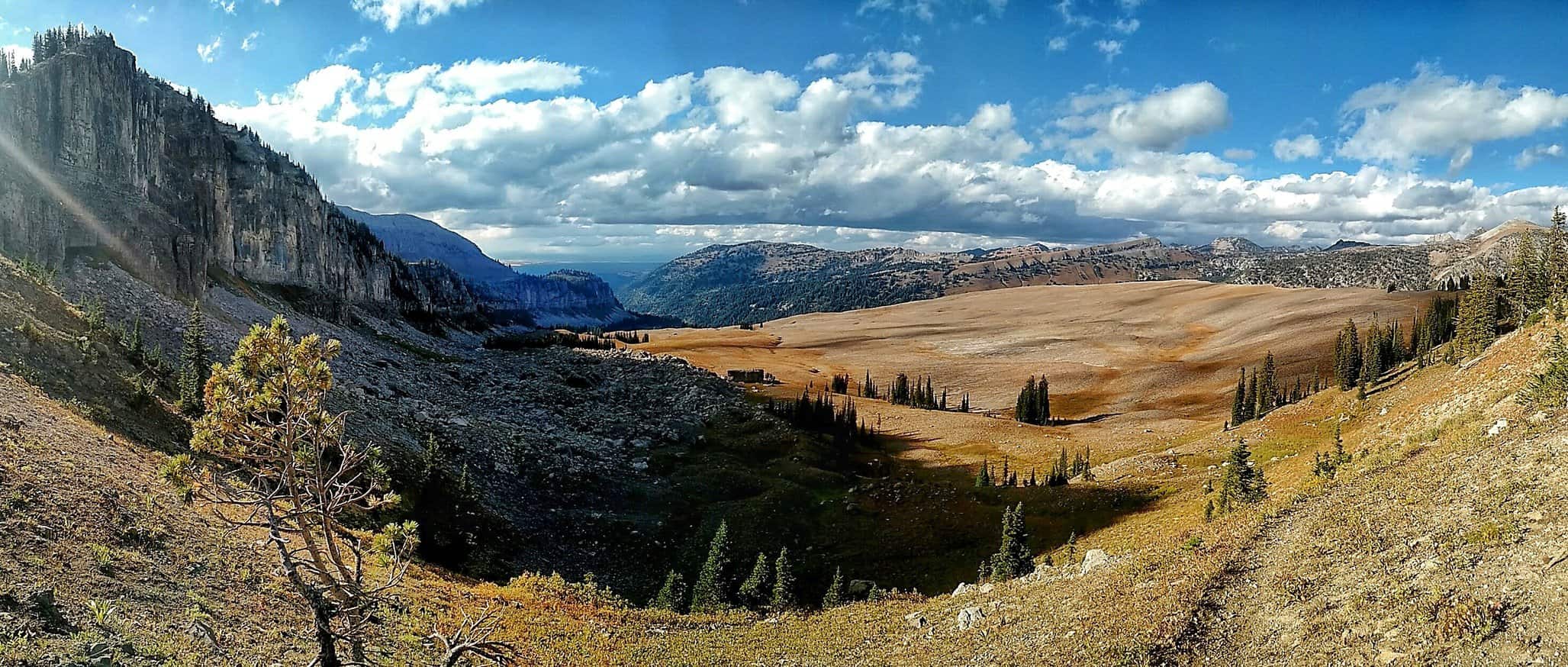
Atop Deadhorse Pass after the junction with Badger Creek, about to drop into Bitch Creek.
I soon intersected with the South Badger Creek Trail. Staying on the North Teton Crest Trail, I began to climb up Deadhorse Pass. From the top, you descend into South Bitch Creek. Yes, that’s the name of this famous creek and drainage (click the link for a history lesson).
South Bitch Creek drainage leading into the Teton River.
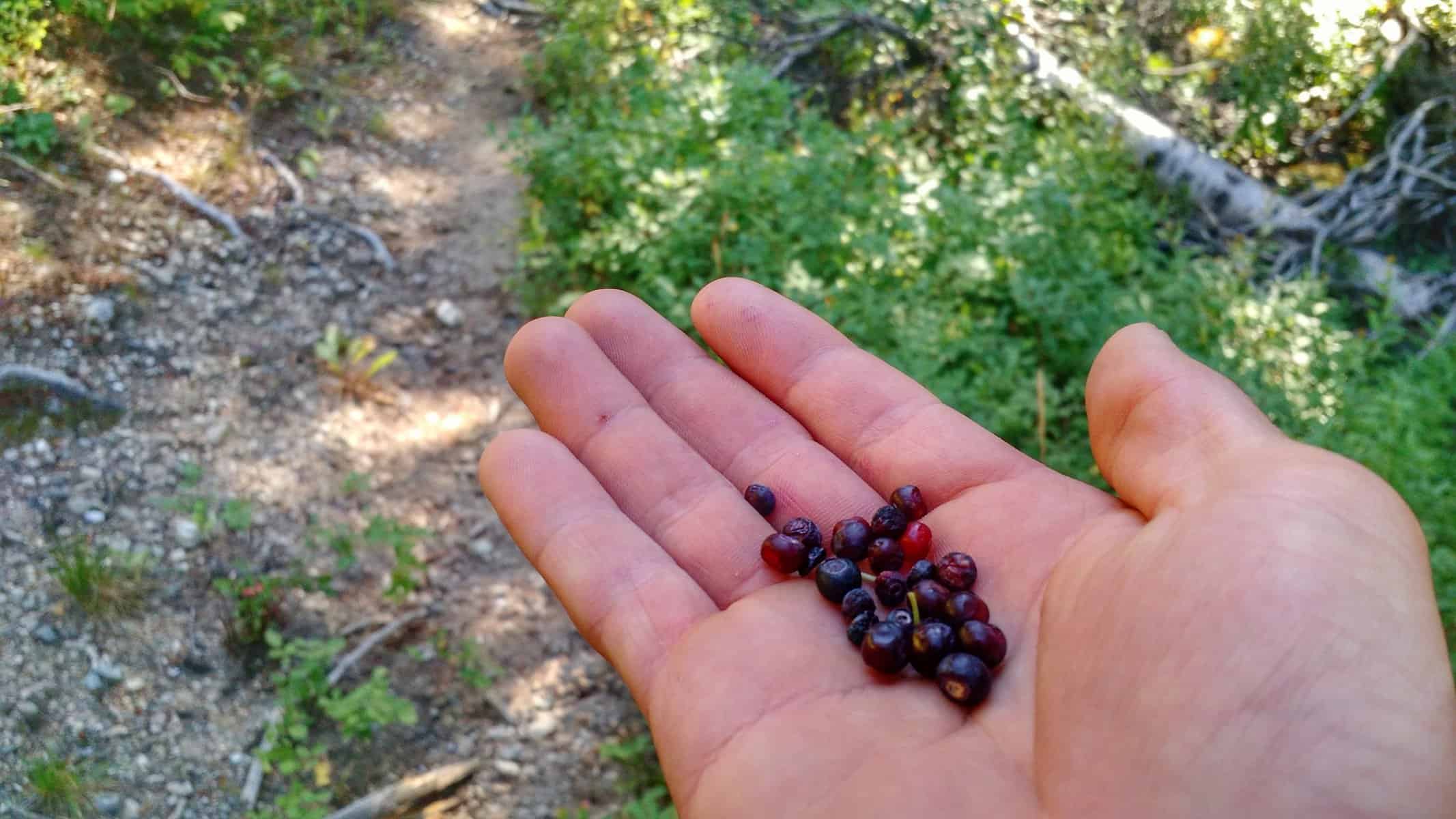
Here I entered into lush mossy woods, crossing more small streams and finding some huckleberries. Unfortunately, the heat and bears got to most of them before I did. I only found 15 fresh ones.
Huckleberries.
The walk down the canyon was refreshingly easy — a great place to pick up some miles. It is a wide canyon and consists of a lot of willows and marshy areas. I was certainly on the lookout for moose and bear but saw nothing. It was late afternoon at this point and I realized I never ate lunch. But I was making good time and didn’t feel the urge to eat — snacks seemed to suffice as I hiked and nibbled on trail mix, Kate’s bars, energy gels, and a candy bar.
Lunch on the go.
Soon another intersection. I would leave South Bitch Creek, continuing to follow the North Teton Crest Trail. This is another big climb which I would push hard to get through. The terrain changed again to steep and rocky with beautiful aspen groves in between summer and fall foliage. The week following this trip I would be back up here for Forest Service work reopening trails for a fire closure and would come upon a black bear sow and cub. It was then that I had the option to turn around, but in the particular case of this trip I wouldn’t have. Smoke was thick in the lower part of the canyon and I had no workaround on this narrow and steep trail. I guess I would have had to just make myself known and read the situation to the best of my knowledge. I was thankful I didn’t have to worry about that after such a long day with several crucial miles to go.
Black bear sow and cub on the same trail, but a week later.
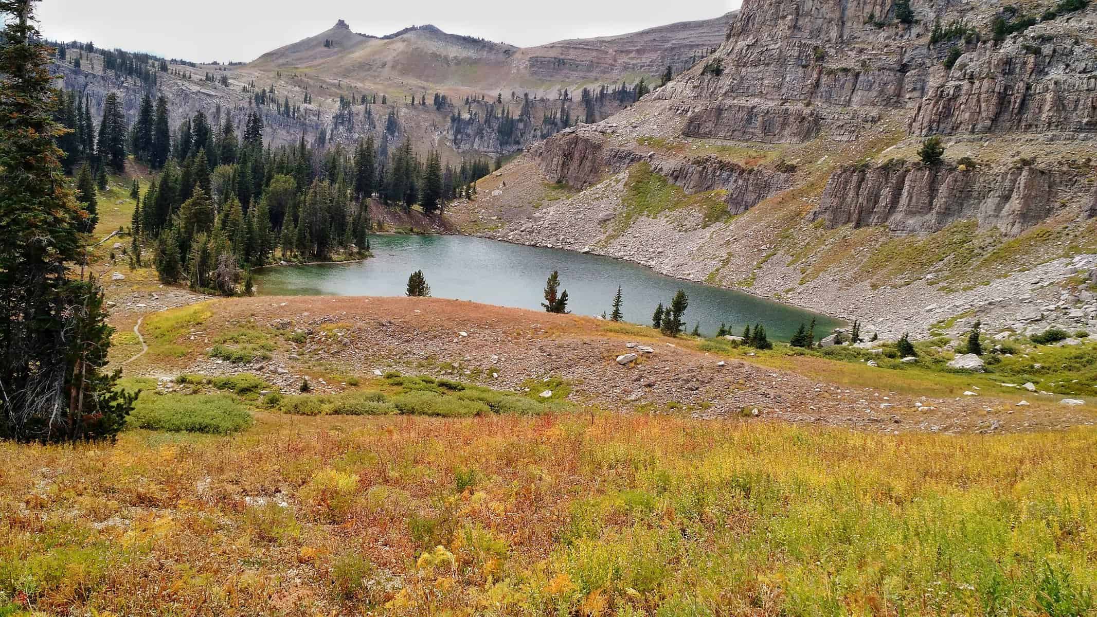
After climbing a couple thousand feet, I arrived at Camp Lake. There are fish in this lake! I saw some small ones. I would love to come back and just enjoy the peaceful serenity here. All I had time for this evening, though, was filtering water.
Camp Lake.
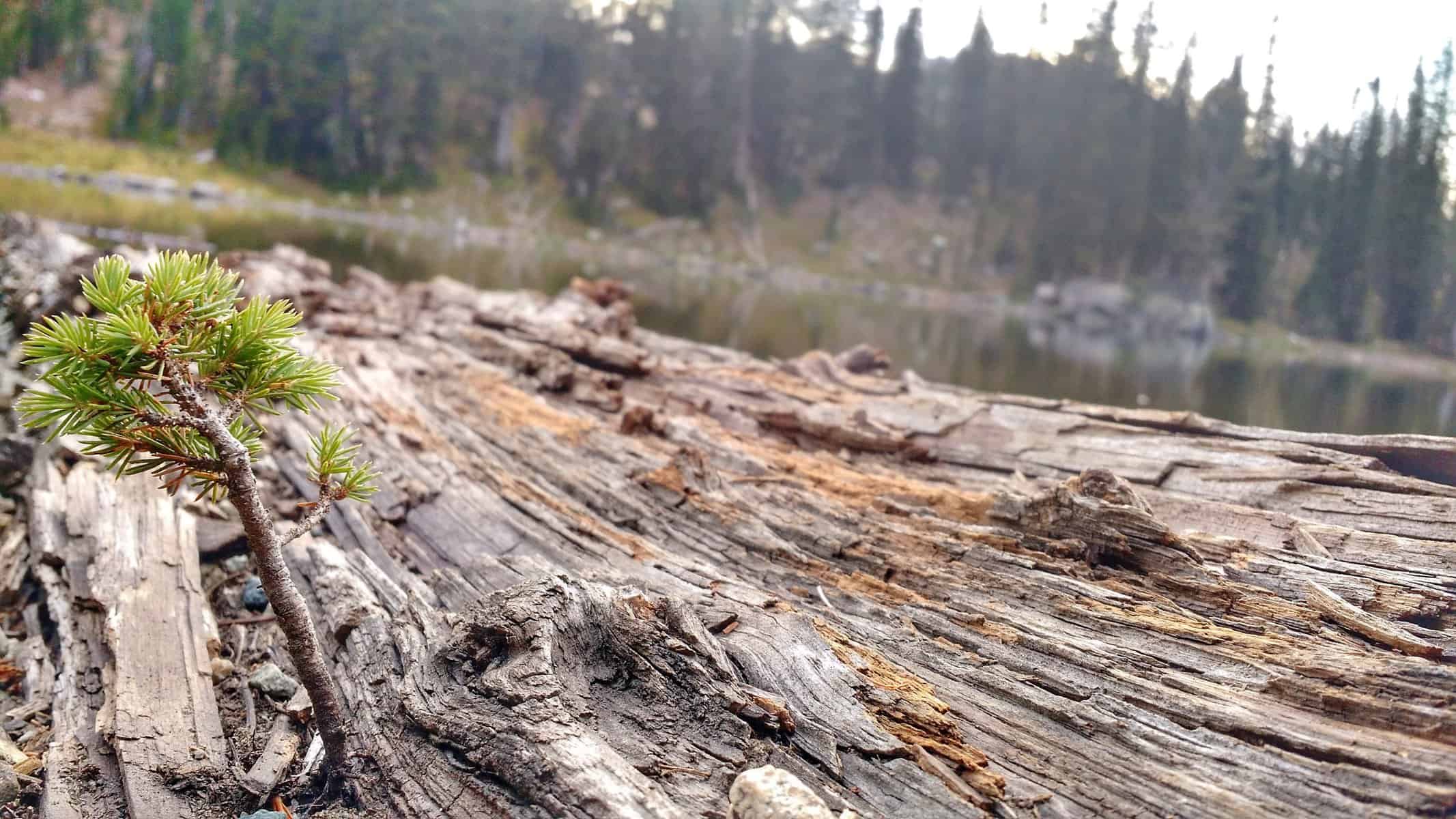
A dead tree, jutting out into the lake offered the perfect platform. Before I discovered it, I was trying to figure out how to get my bottles into deep enough water, as to not get too much sediment in them without getting my feet wet — that was key given I would be ending my day in only a couple short hours. This log was a savior! It’s the little things.
This log jutting out into the lake offered the perfect way to access water. I admired the contrast of this dead tree giving life to another.
With water bottles full, it was time to cover as much ground as possible in the hour and a half left… the sun dropped fast and quickly. I saw a smoke plume from the Carrot Fire. Aside from the section between Hurricane Pass and Table Mountain on the second day, how the fire would affect my route was a big concern. I got the latest update the Saturday before my trip, but there would be a few days between when I would arrive — certainly enough time for some fires to change direction or become significantly bigger. Two cases of that happened locally this summer with the Berry Fire in Grand Teton National Park and the Henry’s Creek Fire in Idaho.
Plume from the Carrot Fire.
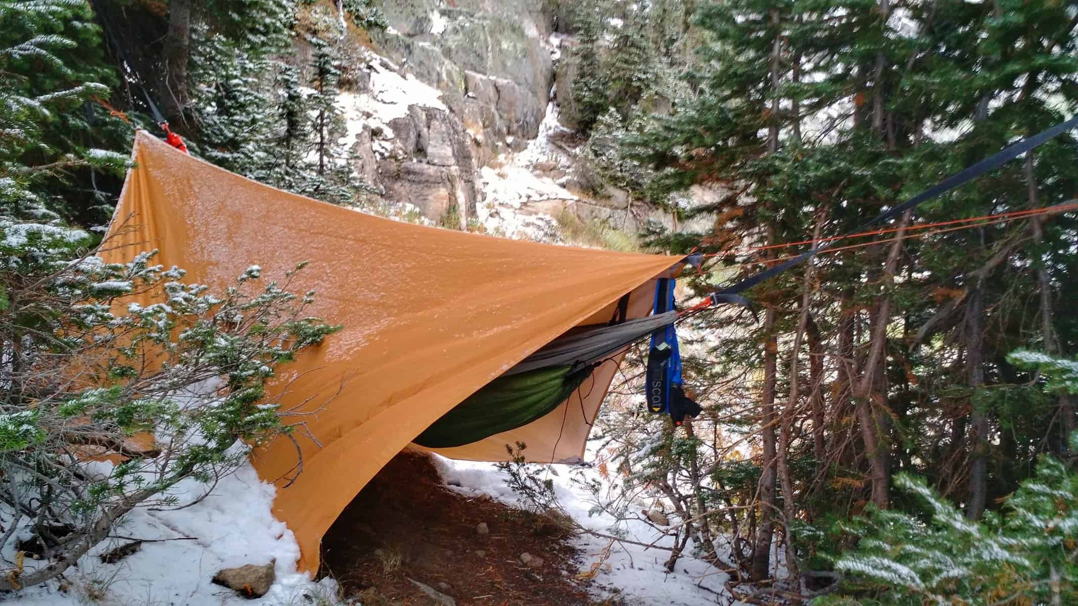
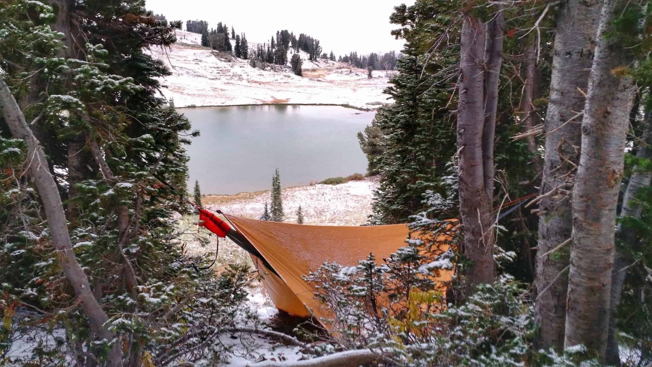
I was thankful to see that the fire was far from my route and I had little to be concerned about. I kept on. The terrain changed again into shale, becoming sparse with trees. Trail got steep as I climbed up to the top of Nord Pass. It was about 8PM now and time to look for a place to hang my hammock. There were still trees, but the spread out groves didn’t offer much to be excited about. I finally found something I could be content with. I wasn’t even going to put up my tarp — the weather didn’t seem too bad. Right about then a big gust of wind came in and blew snow right at my face. Snow?! Where? That was it… 15 flakes… all aimed at my face. I frantically put up the tarp and I’m so glad I did.
After dinner, I haphazardly hung my food bag, but it was the best I could do with what I had. In all honesty, I didn’t even feel like hanging it… but that’s just when a bear would mozy into my camp. I can see it now “Grizzly Attacks Forest Service Employee in Tetons Due to Improper Food Storage.”
This was prime griz country… I could feel it. And see it. The white pines from which my hammock hung between are a favorite food source of the grizzly. The wind didn’t stop. But it had a companion. Smoke. It was blowing northeast, straight up the canyon, carrying all of that smoke from the Carrot Fire. Even once in my hammock with the tarp taught and close to me, I got big whiffs of it. Several times I woke up from nightmares about being burned over… and not sure whether those were true or not, I pulled back the tarp to look for any nearby glows. The wind made all kinds of racket, convincing me in my slumber that an animal was nearby. “HEY! GET OUT OF HERE!” I’d yell. Better to be safe than sorry, I guess… and it’s not like anyone else is going to hear me.
MORE PHOTOS FROM DAY THREE
[slideshow_deploy id=’823′]
DAY FOUR
This view was the highlight of my day.
I was glad morning rolled around. I was hardly sleeping anyway. In fact, I probably should have gotten up hours earlier and hiked in the dark, but I had finally fallen asleep. I quickly stuffed my hammock, quilts, and tarp in my pack, and retrieved my still-intact food bag from the tree (I’m telling you… if a bear had wandered anywhere near it, it would have been gone — I just didn’t have a lot to work with).
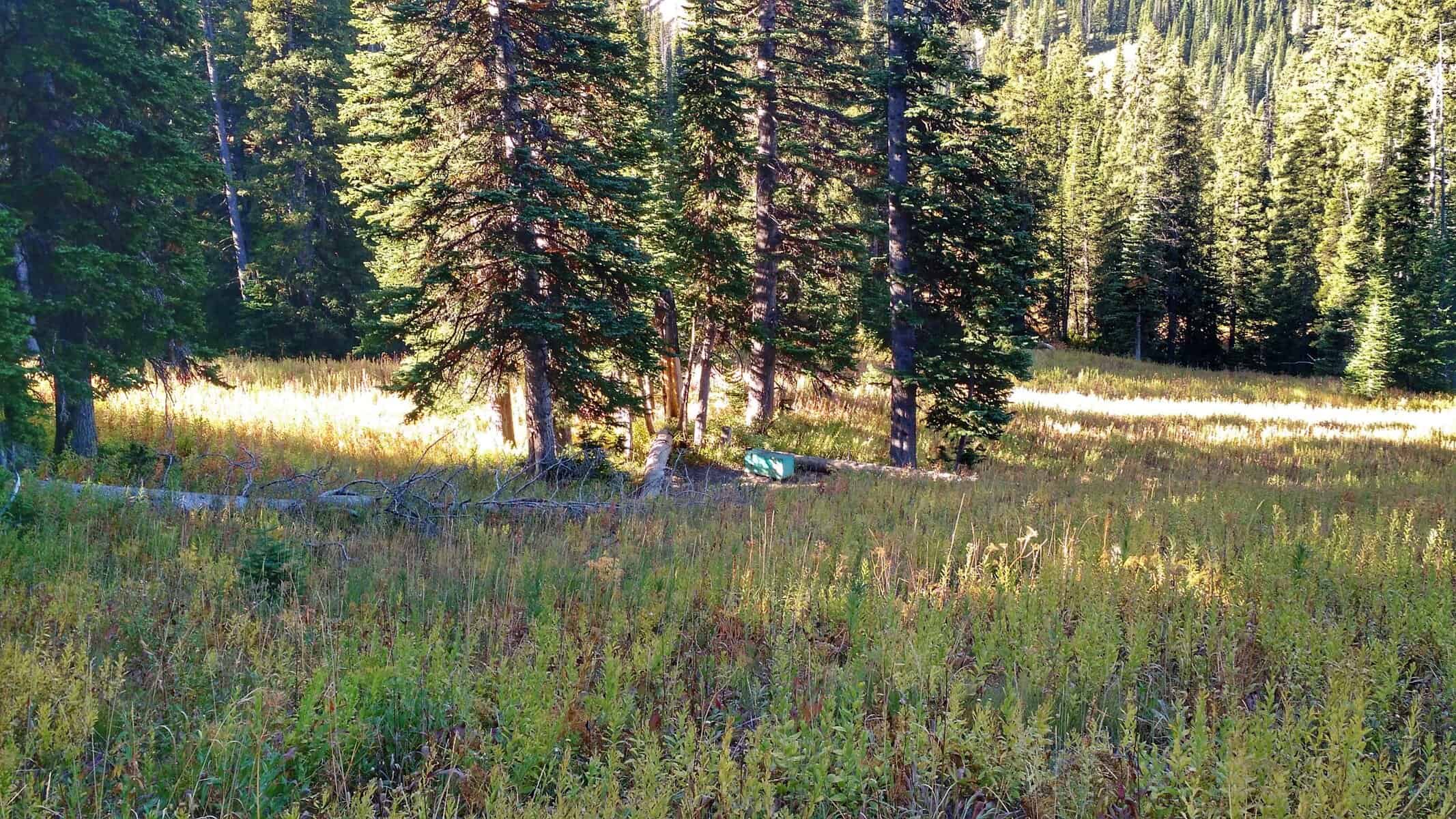
Today’s the day! I made some coffee, which consists of a Starbucks Via packet and chocolate malt powder, put some pre-breakfast snacks in my pockets and hit the trail at 8AM — earlier than the past two mornings. Drinking ice-cold coffee on the trail in the crisp morning air is so refreshing and invigorating, regardless of the previous night’s rest. I crossed some nasty marshy areas and then a nice fresh stream. I was low on water, so I took this opportunity to filter 2 liters. Not long after, I discovered an awesome campsite… with a bear box — out here! A giant, steel box was hauled all the way out here. If only I had known. There were great trees spaced perfectly for hammocking. It was down in a valley, so the high peak and ridge above would have been perfect wind blocking. And I wouldn’t have had to worry about hanging my food bag. AH! I couldn’t help but wish I knew about this place last night. It would have definitely been worth the 2 extra miles in the dark.
Campsite with a bear box that I came upon.
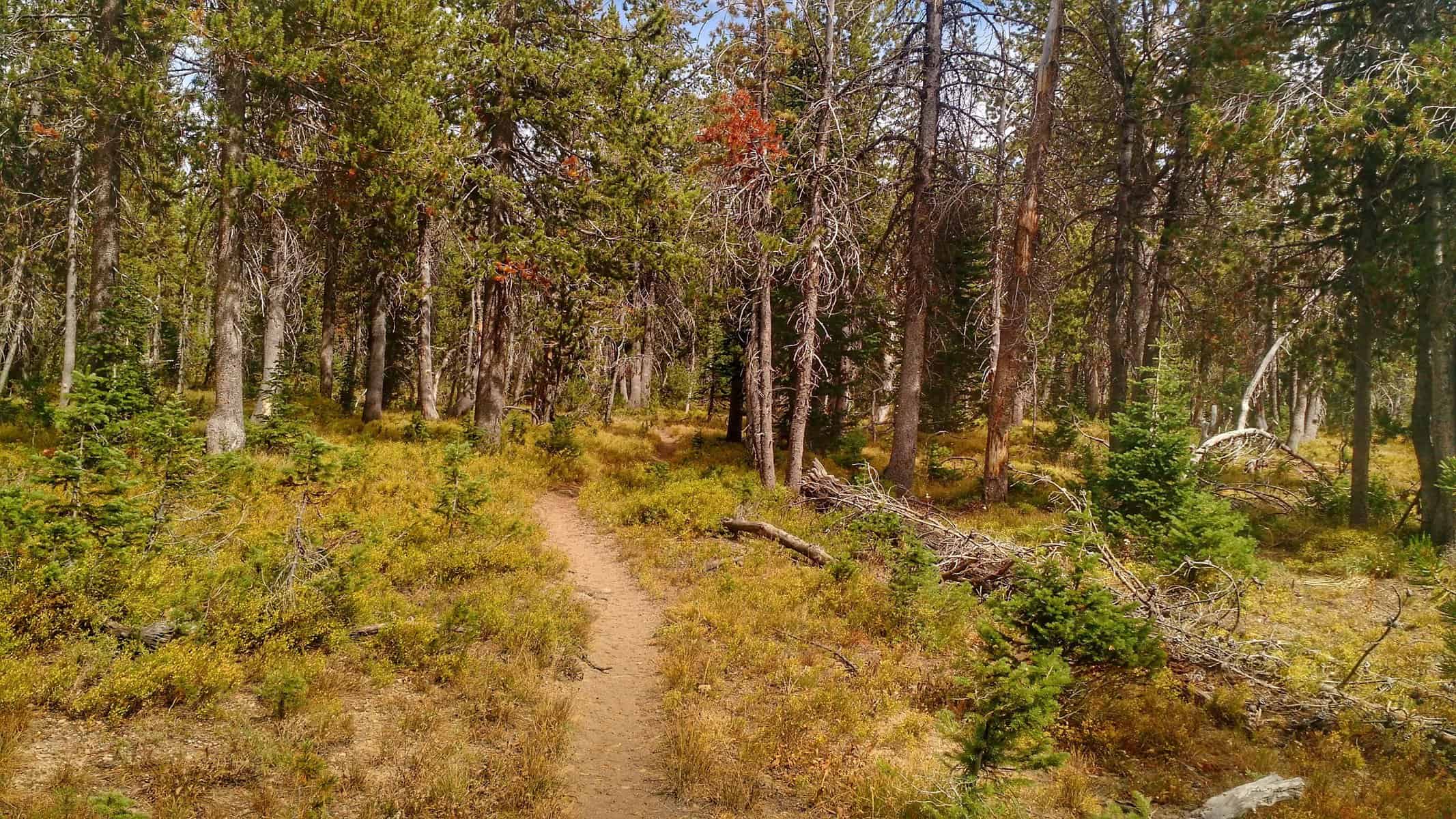
Not many miles later, the trail and its conditions changed significantly. When there was a trail, there was deadfall and user-created reroutes, often steeper and more challenging than the “official route”. But then there was just not a trail at all. At one point I came to an “intersection”. This consisted of a metal post with two signs with trail names and numbers. Had this not been there, there would have been no indication of either trail!
Blazing trail across vole-infested meadows.
But soon it got worse. After walking across an open meadow, the route (notice the change in term!) followed along a steep and exhausting sidehill. In addition to the grade, the soil was ridden with Uinta ground squirrel tunnels, causing you to sink up to your ankle at times in dirt. After crossing a drainage, I found a nice spot for breakfast and a much-needed rest. I was on a “trail” again at the time, but soon after breakfast and continuing on, I lost it. This would be a constant battle for the next few miles and hours — finding the route, then losing it. I constantly was checking the map on my phone and recorrecting my steps climbing up and down hills, all while sinking into dirt and tripping over logs and thick vegetation. It was pretty frustrating and exhausting.
Despite beautiful terrain, I struggled to enjoy it while constantly correcting my course and bushwacking.
Looking back, the cairns on the boulder-ridden meadow between Badger Creek and Bitch Creek on day 3 were a luxury compared to the morning of day 4’s travels.
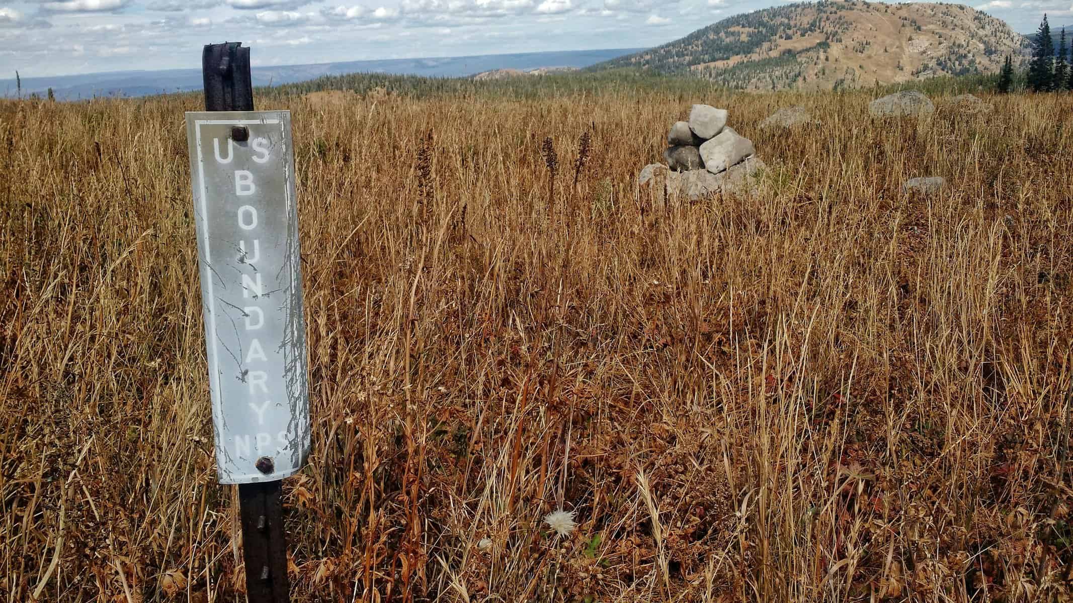
Suddenly, the trail appeared once again and “for good” for the most part. It baffles me where it came from, but it was definitely the right trail. I followed it for a while, through some willows and began to climb. Though the grade was respectfully steep, I gained appreciation for just having a trail. I realized I really don’t care about terrain or elevation or difficulty of traversing it all…. if there’s just a faint trail to follow, it’s good in my book! This took me to the top of Conant Pass, where I straddled the Targhee National Forest and Grand Teton National Park boundary.
Old school boundary markers found on the furthest west border of Grand Teton National Park.
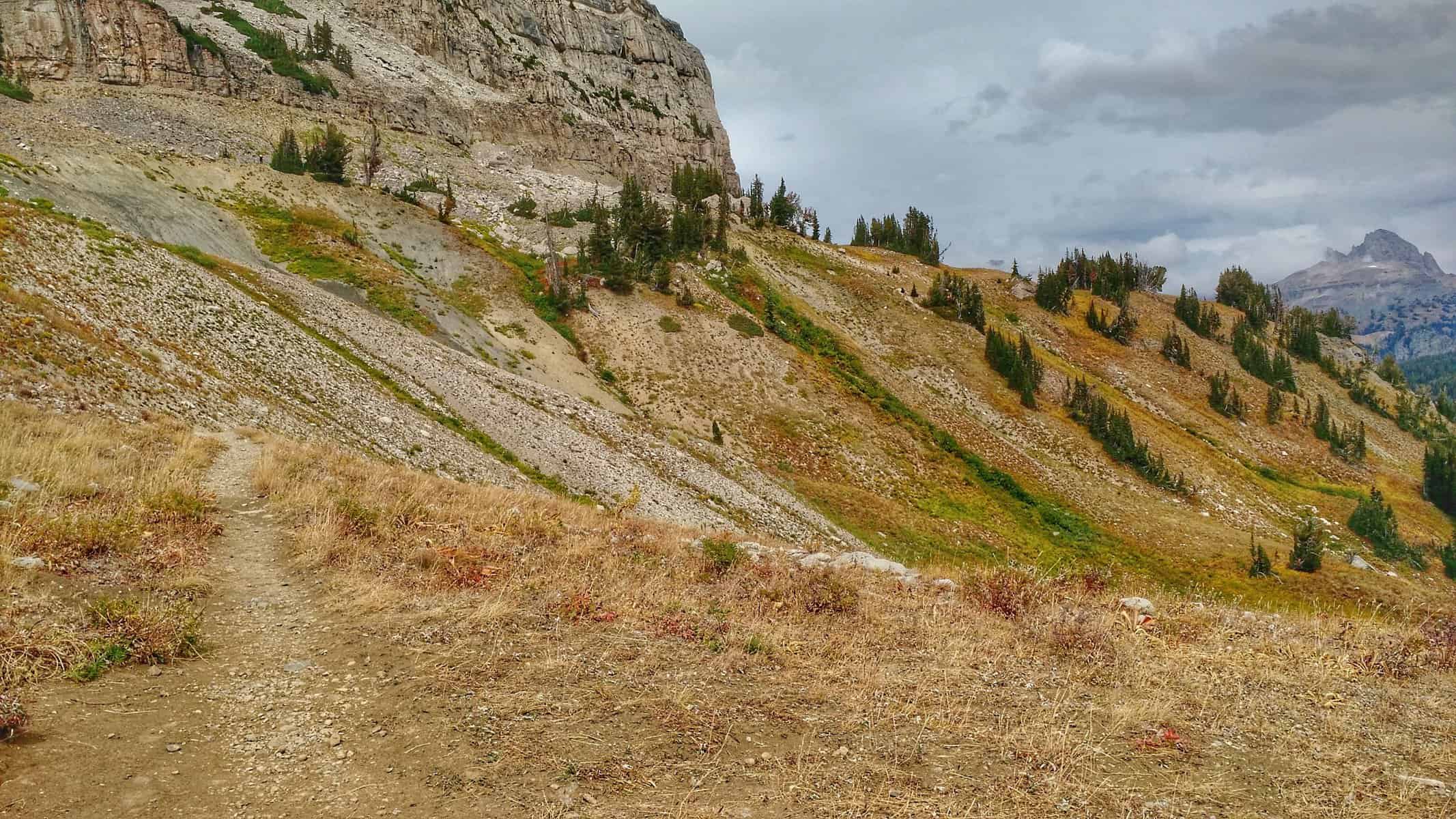
It was a long morning and I was beat, which seemed like no better time for a break and lunch. The wind was relentless in the wide open area, but a boulder provided just the spot for lunch and rest. With one more pass to conquer and who knows how many miles left, I continued along the boundary, focused on knocking out mile after mile. Today was it. There’s no “falling short” of mileage goals. And it was just about now that I realized I miscalculated the final day’s number of miles left. There was definitely no “finishing at 2pm”. Still optimistic, I set my next goal to finish at 5, quickly trying to do the math for the amount of miles I had left, honestly guessing because at this point I had no idea.
The views from Conant Pass weren’t underappreciated while having a break for lunch on day 4.
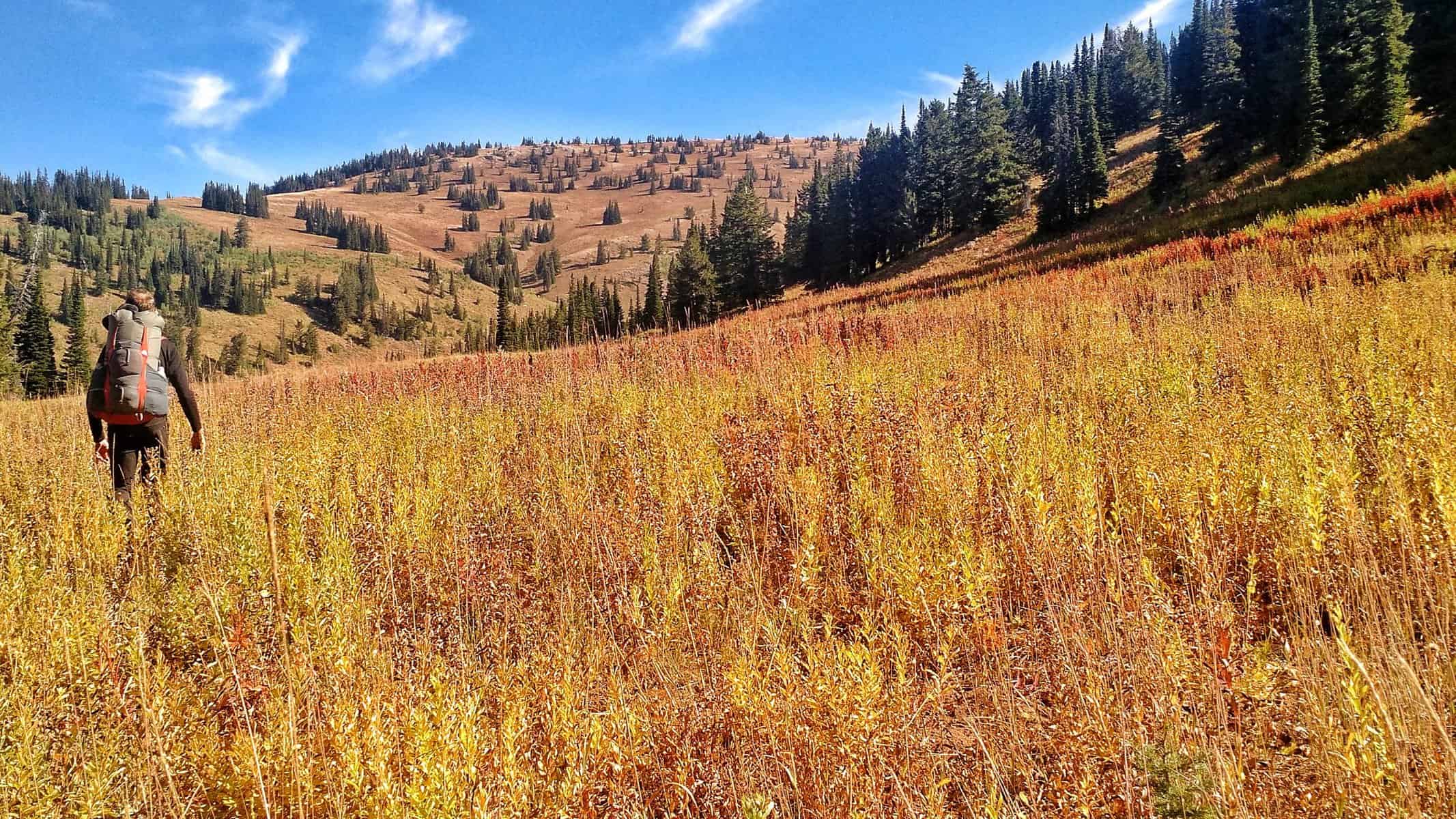
What I had to my advantage though was flat terrain and a trail that eventually became fairly wide and easy to navigate. This allowed me to take in the scenery around me while knocking out mile after mile — this was the kind of hiking I enjoy!
This is where the hiking got good on day 4! Meandering through mostly flat land on the border of Grand Teton National Park. The buff dirt and lush vegetation lifted up my spirits after a rough morning.
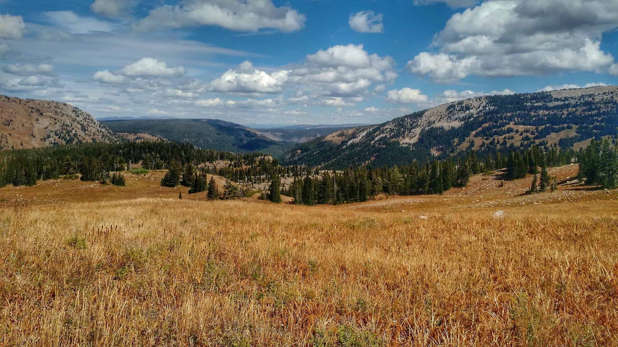
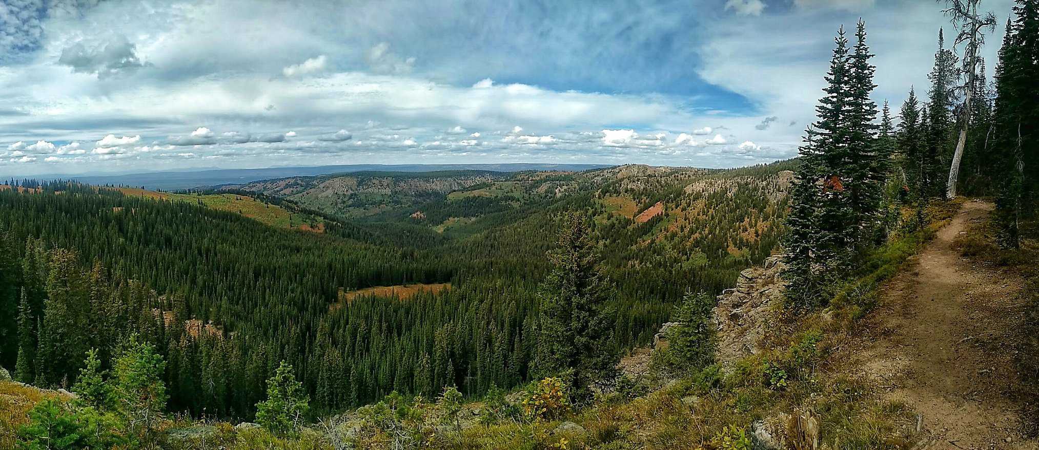
The next pass was Jackass Pass… yeah, I know. What’s with the names in this region? It wasn’t really high above or steep like the others that I had climbed up. The top is more of a plateau with canyons and steep terrain leading up to it, then leveling out. Here the trails intersected again with Hominy Peak to the west and Jackass Pass trail to the east, descending down into Grand Teton National Park and the Berry Creek trail. I continued north which took me along the canyon rim of South Boone Creek, the trail I would eventually take down back to my car.
This view on day 4! Top 5 views and experiences of the whole trip — paralleling the canyon rim and just walking along, taking in the views all around.
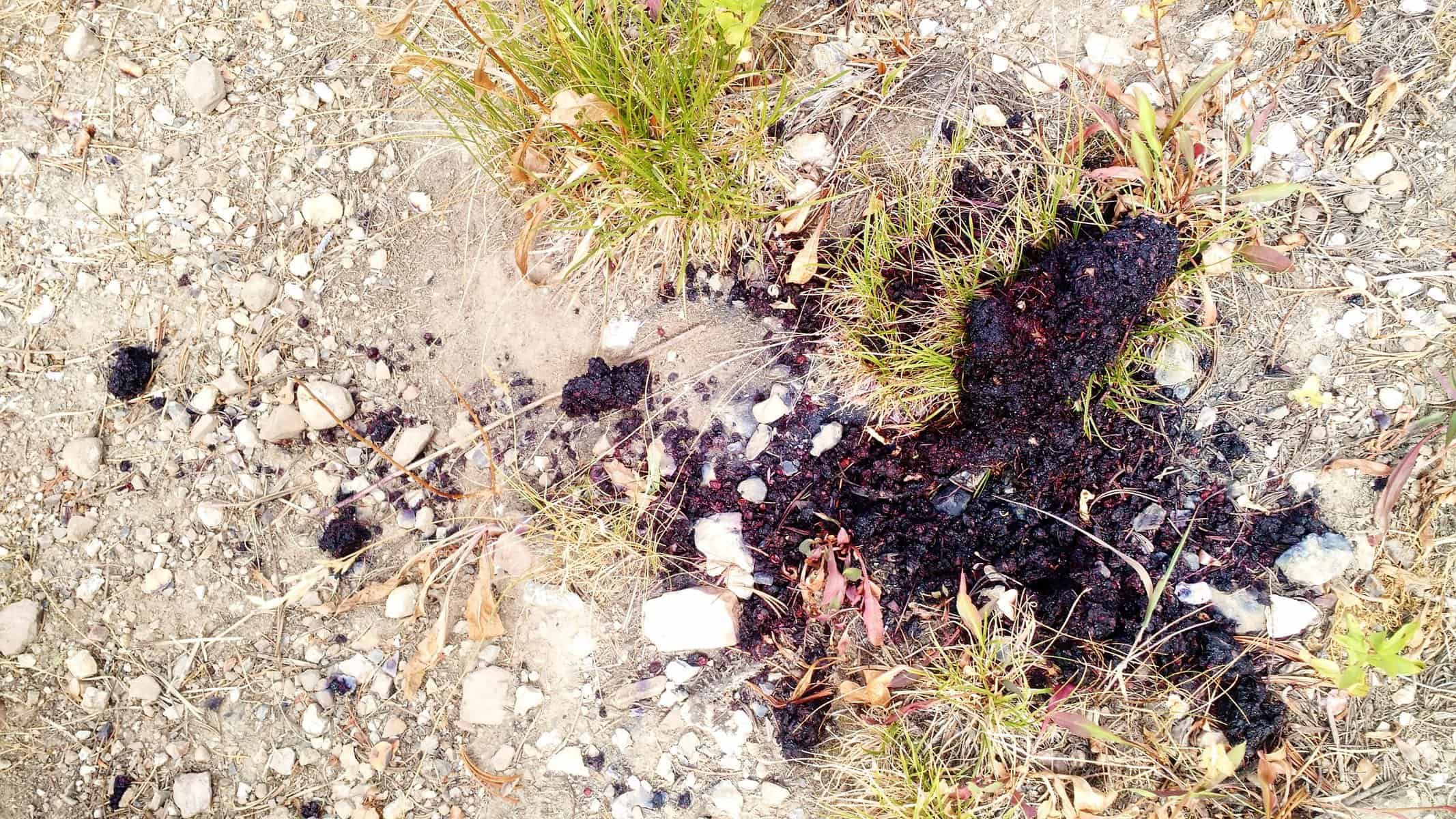
This was no doubt one of the most rewarding stretches of the day. With incredible scenery, great trail conditions and bear scat…. wait, bear scat? And lots of it! I began calling out to make myself known as I walked, and check my surroundings for other evidence.
Not the freshest bear scat I found on the trail, but scat nonetheless.
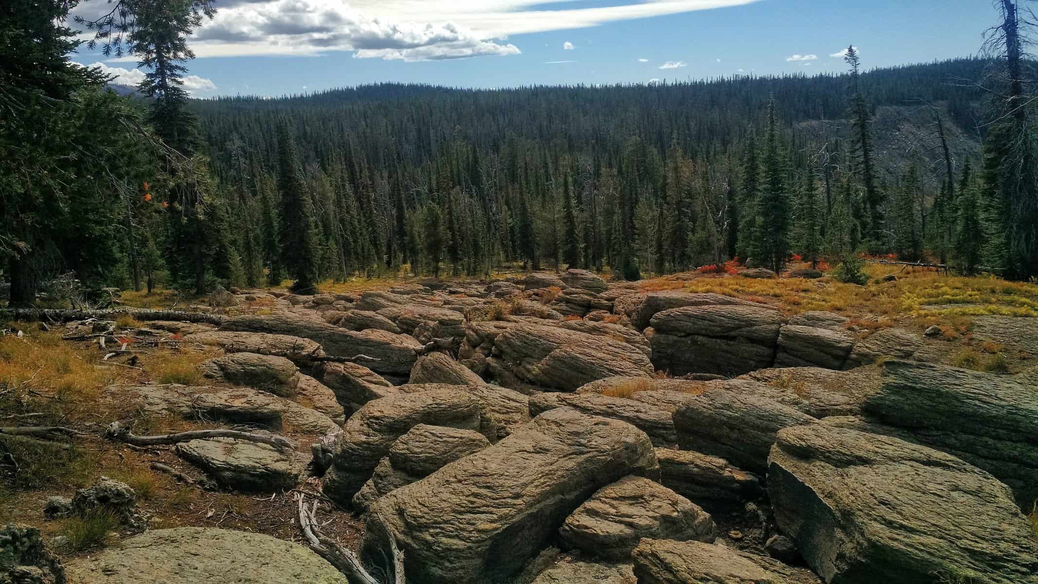
More awesome geological features and scenery followed and though I had miles left, I couldn’t help but stop quickly to admire it.
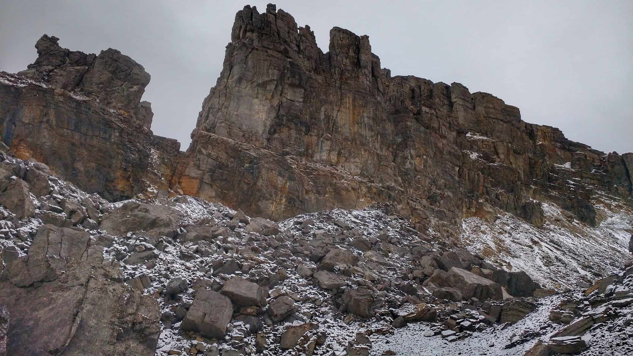
Random and interesting geological feature towards the end of the afternoon on day 4.
Eventually, I intersected with South Boone. Here is where I would depart from the “official North Teton Crest” trail turning east and take the South Boone trail to the west. Most of it was flat or downhill with a few uphill sections. I had enough water. I had a few more snacks. And I had roughly 6 miles left. New goal time: 7 pm. Traveling at roughly 3 miles an hour, I felt I could get back to my car by then and certainly before dark. A few miles down South Boone, I noticed where Middle Boone veered to the north. Broke off is in quotes because there’s no trail here… but it’s on some maps and it’s the official route Petzoldt followed to Lake of the Woods. If you were to take this, it’s bushwacking and route finding from here on out.
South Boone trail offered no shortage of views, which I tried to take in despite a focused push to hike as hard as I could the rest of the way.
It was at this time I was glad I planned my trip to end on South Boone. In the evening, after 4 days and the last really long day of route finding and difficult terrain, having a trail to blaze down was refreshing. Plus, being in grizzly country, isolated and alone, with no real trail at this time of day is kind of a stupid thing — let’s face it.
Looking back from South Boone up the canyon towards the rim which I walked along.
South Boone revealed some really neat scenery of the deep canyon, vast areas of willows with beaver dams, making perfect moose habitat. At one point, I looked back and saw the huge canyon rim I traveled along. The “I came from there!” feeling was overwhelming. I only took a few photos, and hardly stopped to do so. The trail crossed some nasty muddy streams, exasperated by equestrian traffic. I happily walked through a crystal clear creek to clean off my shoes. Wet shoes? No problem. They’ll dry and I’m on a roll — no time for “hop-skip-and-a-jump-ing”. So focused on walking, I realized I was needing an energy boost. I had one thing left — a PayDay candy bar, which was quite satisfying and just what I needed. I kept drinking water, and really as much as I could. The goal? To get back to my car with no water and no food. Any extra was too much weight.
Two and a half miles to go. Then two. Look, bear tracks… black bear to be exact. Make some noise, Aaron. One mile to go… no, nevermind. Two miles to go. OK, keep pushing hard. Don’t let up. You’re almost there. Now, one mile. The trail widens. Shoe prints become evident. And so do the huckleberry bushes. Maintaining my pace, I scan for any fresh berries… none. Either dried up or not ripe — those bears probably had a nice meal, which means those tracks are probably not very recent. Good to know, but stay on guard.
I crest a hill and think I see where the trail ends… does it? Is that… YES! MY CAR! WOOOOHOOOO!! I belt it out without a care in the world. I kind of hope someone hears me and there’s someone camping around the area. No one is, but I don’t care. I am ecstatic! I made it. I freaking made it! Did I just seriously walk across the whole Teton range?! And in 4 days?! For me, this was a surreal and magical moment. I thought maybe some tears would come, but I got distracted by the beautiful cold creek running nearby that I soaked my feet in.
MORE PHOTOS FROM DAY FOUR
[slideshow_deploy id=’837′]
What a trip this was! I arrived at my car at 6:30 and packed in 22 miles on the last day. It ended up being 80.2 miles. 10 more than what I plotted and calculated on my map and computer. But given that I still aimed to average 20 miles per day, I really didn’t miscalculate much. The fourth day was supposed to be a buffer anyway. Granted that the last 10 miles was relatively flat or at a slight decline, I am still amazed at how I hiked the most miles on day 4 than any other day and ended an hour and a half earlier than days 2 and 3. The first section certainly wasn’t easy and ate up a lot of time. Maybe it was the adrenaline, but it showed me that I could have probably even gone harder through some sections. The total elevation gain for the four days was 19,000 feet — roughly 4,700 feet of elevation gain per day.
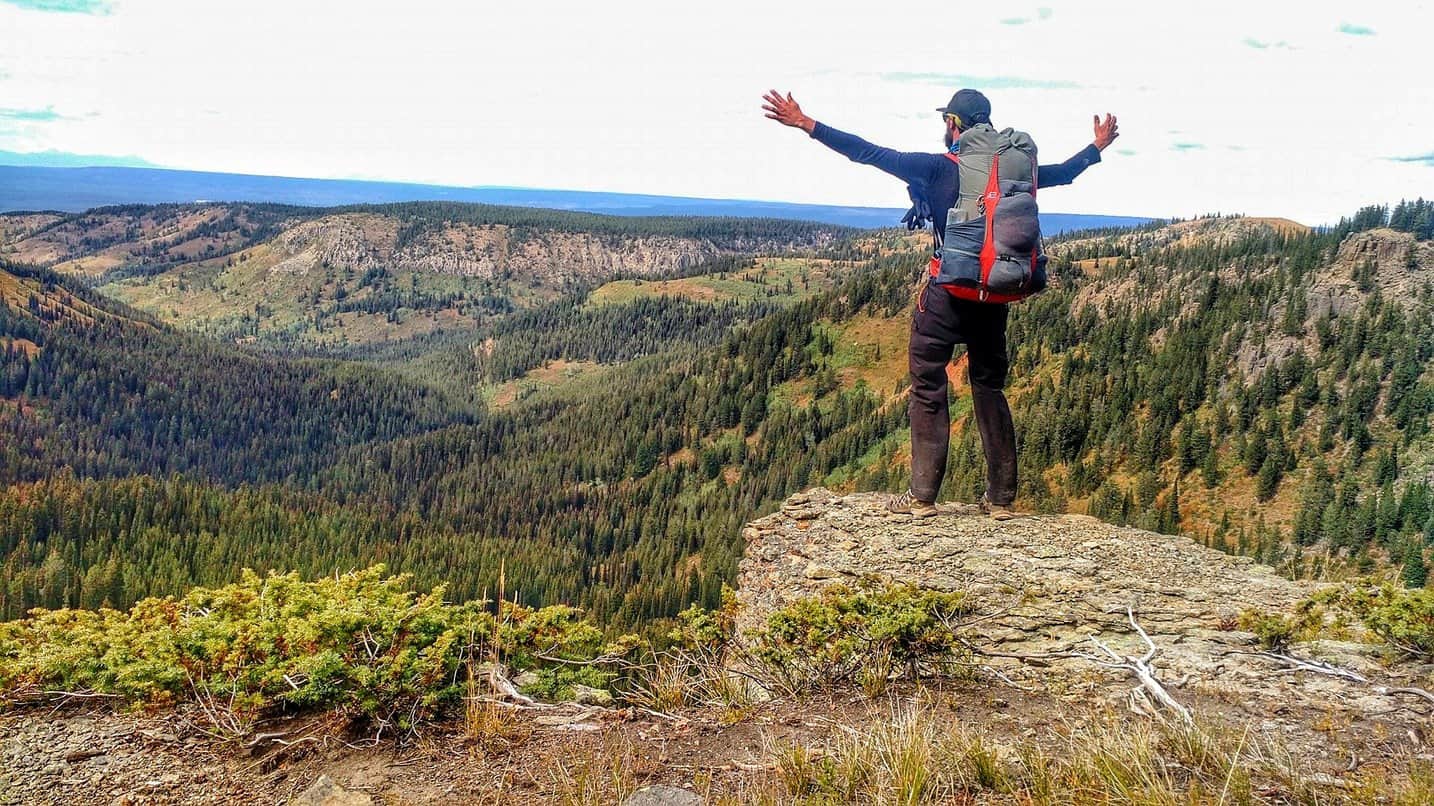
Feeling victory, looking towards what I have left to travel through.
This trek was an unbelievable experience and certainly won’t be the last epic trip in the Tetons, with many other routes I’m already planning on doing. But most of all, I proved to myself that I can plan for big trips. I can conquer big trips. And I can up my game for future big trips. Bring it on!
I too thank you for sharing your experience. I have mixed feelings that stem from the fact that I’m sitting here in my office “working” (the “man, why am I sitting here when I could be there feelings”), and the true desire, inspiration and excitement that I can do this as well. I just need to make some time.
This was a great read! It’s been many years since I’ve done any long-distance hiking and you had me flip-flopping between, “I would give anything to do this hike,” and “I would never attempt this!” Your photos are gorgeous too!
Thanks Tara! I’m glad you enjoyed it! There are a lot of awesome hikes out there. I wouldn’t jump into this one without doing some big day hikes first. Then work up to doing a couple big days back to back and maybe overnighting. By “big” I mean around 20 miles a day.
As you read, I’m also pretty new to trips like this, but you gotta start somewhere, right?! I say always go for adventure, whatever it is. And never stop doing things that scare you.


Hey Aaron, I’m trying to plan out doing this same trail. There are several areas in your writeup that I ‘d like to discuss. Can you contact me?
Hi Brian,
I just reached out via email!
Aaron – your blog inspires with your tales and photos. Beautiful!
I too thank you for sharing your experience. I have mixed feelings that stem from the fact that I’m sitting here in my office “working” (the “man, why am I sitting here when I could be there feelings”), and the true desire, inspiration and excitement that I can do this as well. I just need to make some time.
That’s my goal! To inspire adventure. To fuel that burning desire to go do instead of sit there, wishing, thinking “maybe one day”.
With a trip like this, you could be back to work in a week! I’d recommend this trip in August or September.
Wonderful photographs and journal! I enjoyed this very much and thank you for sharing your journey!
Excellent! I’m glad you enjoyed following it, Margaret! I’ll be sharing many more adventures soon!
Excellent! Glad you enjoyed following it, Margaret! I’ll be sharing some more adventures very soon!
This was a great read! It’s been many years since I’ve done any long-distance hiking and you had me flip-flopping between, “I would give anything to do this hike,” and “I would never attempt this!” Your photos are gorgeous too!
Thanks Tara! I’m glad you enjoyed it! There are a lot of awesome hikes out there. I wouldn’t jump into this one without doing some big day hikes first. Then work up to doing a couple big days back to back and maybe overnighting. By “big” I mean around 20 miles a day.
As you read, I’m also pretty new to trips like this, but you gotta start somewhere, right?! I say always go for adventure, whatever it is. And never stop doing things that scare you.
That sounds like a great adventure — it was a fun read, as well!
Thanks Nathan! It was! Glad you enjoyed it.
Thanks Nathan! It was. Glad you enjoyed reading it!